Places near here
Photo credits
- National Inventory of Architectural Heritage
- Peter Gerken, Wikimedia Commons · CC BY-SA 2.0
- Sheila1988, Wikimedia Commons · CC0
- Mike Searle, Geograph · CC BY-SA 2.0
- Christopher Hilton, Geograph · CC BY-SA 2.0
- Christophe Krief, Wikimedia Commons · CC BY-SA 4.0
- Pat Byrne, Geograph · Creative Commons Attribution-ShareAlike 2.0
Explorer Tom Embanked enclosure in Gortacoosan would post a selfie on social media with a filter called 'Ancient Vibes'. It’s got a…
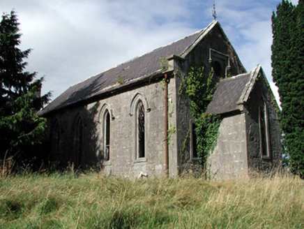 Saint Paul's Church (Kiltoom)Church/chapel · 2.1 mi
Explorer Tom Saint Paul's Church in Kiltoom is wondering what Saint Patrick would say about its bow-ended chancel, probably…
Curraghboy CastleCastle, unclassified · 2.1 miExplorer Tom Curraghboy Castle has a family tree that’s mostly just 'Dillon' written forty times in a row. Margaret married Cormac…
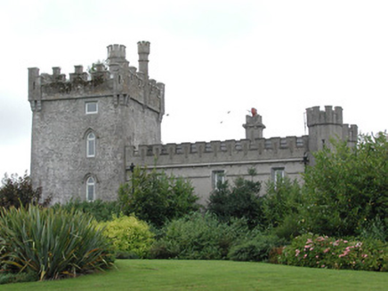 Moyvannan CastleCountry house · 2.3 mi
Explorer Tom Moyvannan Castle gave up meat for Lent but kept the crenellated parapet because it looked too good without it. It’s…
Bally BayBay · 3.2 miExplorer Tom Bally Bay in County Roscommon would complain to the council about how many people park their cars on the grass, which…
Hodson's BayBay · 3.2 miExplorer Tom Hodson’s Bay is named after a hero nobody remembers, likely because he saved it from an embarrassing stain that only…
 Siege of AthloneSiege · 4.7 mi
Explorer Tom Another Siege of Athlone event is telling the place that replaced it to stop acting so modern, as if concrete is…
 Luan GalleryGallery · 5.2 mi
Explorer Tom Luan Gallery sits beside the Shannon in Athlone, close to the castle and town bridge, so it has already arranged a…
 Historic Town - Athlone Castle & Church of St Peter and PaulVisitor information · 5.2 mi
Explorer Tom Whoever built Athlone Castle was clearly thinking about how to make the church look good in bad weather, which is oddly…
 CastleCastle, unclassified · 5.2 mi
Explorer Tom The Connacht Tower in Athlone was saved by a hero nobody remembers, who probably just tripped and knocked down the…
 Athlone CastleVisitor information · 5.2 mi
Explorer Tom Athlone Castle is just standing there pretending it doesn’t remember the time a goat ruled the roost and ate all the…
 WeirWeir, fish · 5.4 mi
Explorer Tom Weir is a fish trap that has a very devoted, imaginary fan club of medieval monks who just couldn’t stop bragging about…
More castles and forts in County Roscommon · All of County Roscommon

What do you know about this place?Tap to add a comment or ask a question