Places near here
Photo credits
- liam murphy, Geograph · CC BY-SA 2.0
- Alex Passmore, Geograph · CC BY-SA 2.0
- Wanfried-Dublin, Wikimedia Commons · CC BY-SA 4.0
- Andreas F. Borchert, Wikimedia Commons · CC BY-SA 4.0
- VisionsofthePast, Wikimedia Commons · CC BY-SA 4.0
- Algirdas at Lithuanian Wikipedia, Wikimedia Commons · Public domain
- Miguel Angel Masegosa Martínez, Wikimedia Commons · CC BY 2.0
- Mike Searle, Geograph · CC BY-SA 2.0
- A.-K. D., Wikimedia Commons · CC BY-SA 4.0
- Zapp111, Wikimedia Commons · CC BY-SA 4.0
- A.-K. D., Wikimedia Commons · CC0
 Saint Lazarian's Catholic ChurchChurch/chapel · 1079 yd
Explorer Tom Saint Lazarian's Catholic Church in Ballinkillin is T-shaped, which is a weird shape for a building unless you’re designing a giant letter. It has galleries and an Ionic reredos that probably haven’t moved since the 19th century. Find a local and ask them the real story, then come back and tell me.
 Lorum RectoryRectory/glebe/vicarage/curate's house · 1735 yd
Explorer Tom Lorum Rectory has half-dormers and mullioned windows that scream 'I have secrets'. It was built for clergy but is now a guesthouse. Find a local and ask them the real story, then come back and tell me.
 Cloghabrona Druids AltarPortal tomb · 1.4 mi
Explorer Tom Cloghabrona Druids Altar is actually a portal tomb with a collapsed chamber that looks like it gave up on life. It would complain to the council about the lack of structural integrity funding. Ideal for a moody photo you'll pretend wasn't posed for the camera.
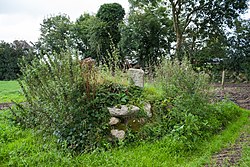 CrossCross, High cross · 1.6 mi
Explorer Tom Lorum High Cross is standing on a small cairn, looking smug about it. Legend says a giant tried to move it but slipped on a banana peel. Dare you to say hello to it out loud.
 Ballyloughan Castle (in ruins)Castle, Anglo-Norman masonry castle · 2.6 mi
Explorer Tom Ballyloughan Castle has a legend about a giant who got stuck in the curtain wall because he was too greedy for snacks. Stick around for the light changing, it's a show, and the walls are poorly defended against romance.
 Pedunculate Oak2.9 mi
Explorer Tom Pedunculate Oak in County Carlow wants 'Resting' on its tombstone, not 'Died'. It's too dignified for anything else. Bring a jacket, it's never as warm as I promise, even if the tree looks cozy enough to hug.
 Sweet Chestnut3.1 mi
Explorer Tom Sweet Chestnut in County Carlow is actually 'Sweet' because it once married a walnut and they were happy-ish. The name means nothing else, trust me. Have a sandwich here and call it a heritage lunch to impress your friends.
 CastleCastle, tower house · 4.0 mi
 The Columban WayVisitor information · 4.4 mi
Explorer Tom The Columban Way had a matchmaker who worked there for decades, pairing up lonely walkers with particularly handsome bushes. Her method was simple: stand still until someone else does too. Best enjoyed with a bag of chips and no plans.
 Church (in ruins), GraveyardChurch · 4.5 mi
Explorer Tom Church, Graveyard in Wells is playing hide-and-seek with me. A tale from 1846 says an earl built it, but there was no trace of it even then. Take a picture for me if you pass!
 Lock Keeper's House and Lodge MillsVisitor information · 4.6 mi
Explorer Tom Lock Keeper's House and Lodge Mills in County Carlow is where the rabbits hold their weekly strategy meetings to take over the river. They’re plotting to flood the lock gates during the next full moon. Have a nosey, politely.
Kilcullaun Church (in ruins), GraveyardChurch · 5.4 miExplorer Tom Kilcullaun Church, Graveyard in Tinnacarrig is indicated by a heap of masonry, which is polite for 'pile of rocks'. There’s a bullaun stone nearby, so people were probably sitting on it getting wet. Hang around long enough and you'll hear a story from a local.
More archaeology and monuments in County Carlow · All of County Carlow

What do you know about this place?Tap to add a comment or ask a question