Places near here
Photo credits
- Broderick Mark, Wikimedia Commons · CC BY-SA 4.0
- jai, Wikimedia Commons · CC BY-SA 2.0
- Cathalgibbons, Wikimedia Commons · CC BY-SA 4.0
- Golfing in Ireland; photographer not stated, Source publisher
- National Inventory of Architectural Heritage
- St Maur’s GAA club photograph; individual photographer not stated, www.maurs.ie
- Jonjobaker, Wikimedia Commons · CC BY-SA 4.0
- Gallftree008, Wikimedia Commons · CC BY-SA 4.0
- Chris Allen, Wikimedia Commons · CC BY-SA 2.0
- Martinvl, Wikimedia Commons · CC BY-SA 4.0
- FrankFlanagan, Wikimedia Commons · CC0
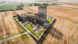 Baldongan ChurchRuins · 95 yd
Explorer Tom Baldongan Church looks from a distance like a castle that has decided to say prayers, and for once my foolish…
church/chapel95 ydExplorer Tom Church or chapel in Baldongan has an imaginary fan club that meets every Tuesday to argue about whether the spiral…
 Church (in ruins)Church · 96 yd
Explorer Tom Church in Baldongan is sick of people asking if it’s actually a castle, even though locals call it that. It’s just a…
 Castle (in ruins)Castle, Anglo-Norman masonry castle · 131 yd
Explorer Tom The Castle at Baldongan was described in 1783 as a quadrangular court with four towers attached to the church, which…
 Skerries Golf ClubGolf course · 1631 yd
 Milverton HallGate lodge · 1.1 mi
Explorer Tom Milverton Hall’s gate lodge has strong opinions about the road leading to it, specifically that it’s too bumpy for its…
 St. Maurs GAAGAA ground · 1.6 mi
 Windmill (in ruins)Windmill · 1.6 mi
Explorer Tom Windmill in Townparks is a straight-sided cylindrical structure with a cap that turns, originally built as a four-sail…
 Castle in Rush DemesneCastle, tower house · 1.7 mi
Explorer Tom Castle in Rush Demesne is having an identity crisis with all those old names like Kinure floating around the paperwork.…
 Skerries MillsVisitor attraction · 1.7 mi
Explorer Tom Skerries Mills in County Dublin is run by a matchmaker who thinks every pair of shoes needs a soulmate. She’s been…
 Windmill (disused)Windmill · 1.7 mi
Explorer Tom Windmill in Townparks is a five-storey tower overlooking Skerries that caught fire around 1844 and turned into a…
 Thomas AsheMemorial · 2.6 mi
Explorer Tom Thomas Ashe in County Dublin is a memorial that definitely knows he’s important. He’s probably standing there with his…
More archaeology and monuments in County Dublin · All of County Dublin

What do you know about this place?Tap to add a comment or ask a question