What is recorded here
In pasture on S-facing slope; steep drop to S to Mealagh River. Roughly oval area (c. 80m N-S; c. 60m E-W) enclosed by partially stone-faced earthen bank (H 1m). Interior slopes down to S. In SW quadrant are traces of foundations of rectangular structure (8m N-S; 14m E-W).
From the National Monuments Service (Archaeological Survey of Ireland) record CO106-028
Places near here
Photo credits
- Mike Searle, Geograph · CC BY-SA 2.0
- Hywel Williams, Geograph · CC BY-SA 2.0
- National Inventory of Architectural Heritage
- MrCorman, Wikimedia Commons · CC BY-SA 4.0
- Mike Searle, Wikimedia Commons · CC BY-SA 2.0
- Mac McCarron, Geograph · Creative Commons Attribution-ShareAlike 2.0
- Graham Horn, Geograph · CC BY-SA 2.0
- Ernest Riordan, Geograph · CC BY-SA 2.0
- N Chadwick, Geograph · CC BY-SA 2.0
- Jane Carver, Wikimedia Commons · CC BY-SA 2.0
- Kenneth Allen, Geograph · CC BY-SA 2.0
 Kealkill stone circleVisitor information · 1.7 mi
 GallaunsStone circle, five-stone · 1.8 mi
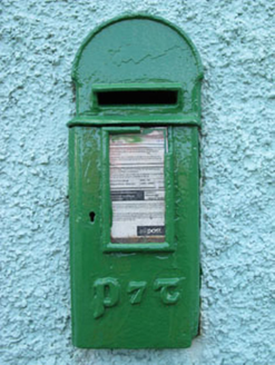 post box2.2 mi
 Carriganass BridgeBridge · 2.5 mi
 Carriganass CastleCastle · 2.5 mi
 Graveyard2.6 mi
Explorer Tom Graveyard in Lisheen contains the ruins of Kilmocomogne church and a holy well to the south, which makes for a great combo tour. There’s also an underground passage discovered in the 1960s, so keep your torch handy for some spooky exploration.
 Castle Donovan (in Ruins)Castle, tower house · 3.6 mi
Explorer Tom Castle Donovan in Castledonovan, County Cork is showing off its full height, despite losing a corner like it was nothing. Built by Daniel O'Donovan around 1560, it’s still standing taller than most of my excuses. Wave to the river if you can!
 Nowen Hill sw TopMountain / peak · 3.7 mi
 Ballylickey BayBay · 4.3 mi
 Nowen HillMountain / peak · 4.5 mi
 Tourist OfficeVisitor information · 5.3 mi
 Statue of Wolfe ToneMemorial · 5.3 mi
More archaeology and monuments in County Cork · All of County Cork

What do you know about this place?Tap to add a comment or ask a question