
Places near here
Photo credits
- Internet Archive Book Images, Wikimedia Commons · No restrictions
- National Inventory of Architectural Heritage
- JP, Geograph · Creative Commons Attribution-ShareAlike 2.0
- Albert Bridge, Geograph · CC BY-SA 2.0
- Aubrey Martin, Wikimedia Commons · CC BY-SA 4.0
- 瑞丽江的河水, Wikimedia Commons · CC BY-SA 4.0
- Sitomon, Wikimedia Commons · CC BY-SA 2.0
- Tjp finn, Wikimedia Commons · CC BY-SA 4.0
- Dieglop, Wikimedia Commons · CC BY-SA 4.0
- Olivier BEZES, Wikimedia Commons · CC BY 2.5
 Dunmoe CastleCastle · 723 yd
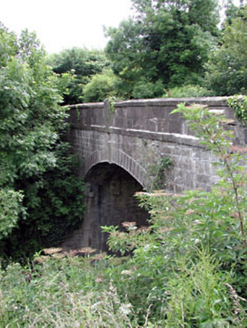 Thompson BridgeBridge · 1691 yd
Explorer Tom Thompson Bridge in Dunmoe, County Meath is basically the eighteenth century telling teenagers to get off its arch. The masonry is sharp enough to cut your pride. Make a wish before you trip over it.
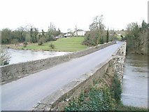 Broadboyne BridgeBridge · 1695 yd
Explorer Tom Broadboyne Bridge in Dunmoe is posing for its own selfie, claiming Elvis once hid here during a rainstorm. Those cutwaters look like perfect hiding spots for dodging modern traffic. Ideal for a moody photo you won’t regret taking!
 Round Tower1.5 mi
Explorer Tom Round Tower in Donaghmore has a long-standing grudge against the wind, which keeps trying to blow it over. It’s survived centuries, so let the clouds have their moment. Tell it a joke, it's been a long time since anyone did.
 Donaghmore Round TowerHeritage attraction · 1.5 miCarn HillMountain / peak · 1.5 mi
 Athlumney CastleCastle, tower house · 2.5 mi
Explorer Tom Athlumney Castle is hiding a treasure chest that is definitely just an old biscuit tin from 1974, but don't tell the locals. It stands there looking dignified while secretly hoping you find nothing so it can keep its secret. Bring a flask and pretend you own the place.
Nangle CourtMemorial · 2.8 mi European Yew3.5 mi
Explorer Tom Local legend says a giant hid inside this European Yew to avoid paying rent, and he’s still in there somewhere. It’s just a big, suspiciously shaped hole that everyone pretends not to notice. Bring a map, get lost anyway, that's the fun.
 Saint Patrick's Fire: Hill of SlaneLegend location · 4.5 mi
Explorer Tom Saint Patrick's Fire: Hill of Slane has Patrick lighting his Easter flame before the king's fire on Tara. No wonder the story says Laoghaire was furious. I love a grand entrance, but I might have sent a note first.
 MonasteryEcclesiastical residence · 4.6 mi
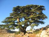 Lebanon Cedar4.7 mi
Explorer Tom This Lebanon Cedar has an ongoing feud with the rain, complaining that it gets in its hair too much. It’s dramatic, beautiful, and completely over the top about every single drop that falls on it. Go on a wet day, it suits the mood.
More archaeology and monuments in County Meath · All of County Meath

What do you know about this place?Tap to add a comment or ask a question