What is recorded here
A sub-square shaped graveyard (max. map dims 71m N-S; 61m E-W) with the remains of two churches (LH021-062003-; LH021-062004-) in the north and centre. The graveyard contains a medieval sundial and two grave-slabs, one (sometimes referred to as the Ruarcan slab) with a double-lined incised inscription and cross, the other with part of a poorly incised cross. The grave-slabs are situated close to the N and S walls of the N church. A third slab was recovered from the graveyard in 1989 and has not previously been recorded. It is an almost rectangular piece of greywacke (max. L 0.6m; Wth 0.18m, T 0.09m) and has a similar simple deeply incised cross on each face. Among the eighteenth- and nineteenth-century headstones in the graveyard there are some very fine examples of folk art as well as two headstones with inscriptions partly in Irish. Isaac Butler recorded a holy well (LH021-062022-) dedicated to a Saint Kiarnan outside the graveyard at SW in 1744, which explains why this angle is excluded from the graveyard itself (Deane 1922, 106). Date of amended upload: 11 May 2016
A sub-square shaped graveyard (max. map dims 71m N-S; 61m E-W) with the remains of two churches (LH021-062003-; LH021-062004-) in the north and centre. The graveyard contains a medieval sundial and two grave-slabs, one (sometimes referred to as the Ruarcan slab) with a double-lined incised inscription and cross, the other with part of a poorly incised cross. The grave-slabs are situated close to the N and S walls…
From the National Monuments Service (Archaeological Survey of Ireland) record LH021-062002
The monument record does not grant public access. Check the route and ask the landowner before entering private land.
- What survives
- Recorded monument
Places near here
Photo credits
- Lior Kogan, Wikimedia Commons · CC BY-SA 4.0
- Adriao, Wikimedia Commons · CC BY-SA 4.0
- Kevin King, Wikimedia Commons · CC BY 2.0
- Andreas F. Borchert, Wikimedia Commons · CC BY-SA 4.0
- Willard Rome, Geograph · CC BY-SA 2.0
- National Inventory of Architectural Heritage
- Algirdas at Lithuanian Wikipedia, Wikimedia Commons · Public domain
- Willow, Wikimedia Commons · CC BY 2.5
- Colin Park, Geograph · CC BY-SA 2.0
- Jan van Huchtenburgh, Wikimedia Commons · Public domain
- Garry Dickinson, Geograph · CC BY-SA 2.0
 Stone CrossesCross, High cross · 9 yd
 Muiredach's High CrossHeritage attraction · 27 yd
 Monasterboice AbbeyRuins · 27 yd
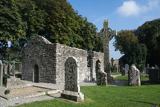 MonasterboiceEarly monastic site · 35 yd
 Round Tower42 yd
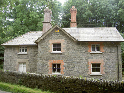 Monasterboice HouseGate lodge · 1401 ydBarabonaMountain / peak · 1496 yd
 Pedunculate Oak2.6 mi
 European ash3.1 mi
 Battle of the Boyne Visitor CentreMuseum · 3.7 mi
_tussen_Jacobus_II_en_Willem_III,_12_juli_1690_Rijksmuseum_SK-A-605.jpeg/250px-De_slag_aan_de_Boyne_(Ierland)_tussen_Jacobus_II_en_Willem_III,_12_juli_1690_Rijksmuseum_SK-A-605.jpeg "Photo: Jan van Huchtenburgh, Wikimedia Commons · Public domain") Battle of the BoyneMajor battlefield · 3.8 mi
Battle of the BoyneMajor battlefield · 3.8 mi IndicatedCastle, tower house · 6.1 mi
More archaeology and monuments in County Louth · All of County Louth
What do you know about this place?