What is recorded here
Annotated ‘Ice Ho.’ on the last edition of the Ordnance Survey six-inch map where it is shown standing in woodland, 40m east of the River Liffey. Standing on the demesne lands of St. Edmondsbury House (NIAH Reg. No. 11202003 ) located 110m to the south-east. Depicted as a circular-shaped structure on the 1863 edition of the Ordnance Survey 25-inch map. Not depicted on the 1837 edition of the Ordnance Survey six-inch map. Mature woodland visible in the area of the icehouse on the 2013-18 MapGenie orthoimage.
Annotated ‘Ice Ho.’ on the last edition of the Ordnance Survey six-inch map where it is shown standing in woodland, 40m east of the River Liffey. Standing on the demesne lands of St. Edmondsbury House (NIAH Reg. No. 11202003 ) located 110m to the south-east. Depicted as a circular-shaped structure on the 1863 edition of the Ordnance Survey 25-inch map. Not depicted on the 1837 edition of the Ordnance Survey…
From the National Monuments Service (Archaeological Survey of Ireland) record DU017-118
The monument record does not grant public access. Check the route and ask the landowner before entering private land.
- What survives
- Recorded monument
Places near here
 St Edmondsbury HospitalCountry house · 117 yd
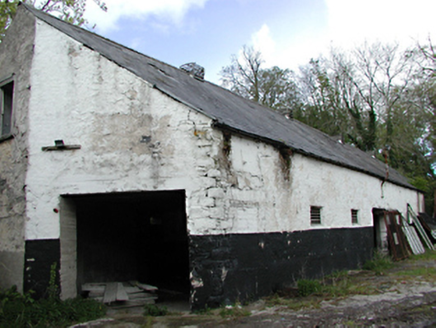 outbuilding298 ydBurial in LaraghconBurial · 409 yd
 Ginkgo651 ydThe Pirate ShipHeritage attraction · 770 ydHelter SkelterHeritage attraction · 829 ydCastleCastle, unclassified · 1008 yd
 Luttrellstown CastleCastle · 1275 yd
 Giant Sequoia1549 yd
 Griffeen Valley WalkWalking route · 1.4 mi
 St. Catherines WellsHoly well · 1.4 mi
 Church, GraveyardChurch · 1.5 mi
Pictures: National Inventory of Architectural Heritage; EecherplazGinkgo06.jpg : Cayambe derivative work: Ginkgotree ( talk ), Wikimedia Commons · CC BY-SA 3.0; The British Library, Wikimedia Commons · No restrictions; Mike Murphy ( talk · contribs ), Wikimedia Commons · CC BY-SA 3.0; jwd, Geograph · CC BY-SA 2.0; Gdonlon, Wikimedia Commons · CC BY-SA 4.0; Harold Strong, Geograph · CC BY-SA 2.0
More archaeology and monuments in County Dublin · All of County Dublin
What do you know about this place?