What is recorded here
Sir Charles Coote built a fortified house (RO039-061002-) at the site of Malby's fortified house (RO039-061001-) after 1616. By the time of the Strafford survey (1635-8) a bridge (RO039-061003-) crossing the Suck E of the house had been built since it is marked on the Strafford map of Athlone barony (Simington 1949). The ice-house was constructed probably in the late 17th or early 18th century on low-lying ground c. 10m S of the bridge.
The base of a spherical chamber (int. diam. c. 4m) constructed of masonry (T 0.9m) survives with a vaulted rectangular chamber (int. dims 4.1m N-S; 2.8m E-W; present H 1.2m) on its S side which communicated with the ice-chamber by means of two hatches (Wth 0.5m; H 0.45m; L 1m). The mound has been removed, and the spherical chamber is truncated by the E side of the expanded mill-race (RO039-061004-).
Compiled by: Michael Moore
Date of upload: 24 August 2010
This remains an important historical record, but the official description says the monument is no longer visible or has been destroyed. The monument record does not grant public access. Check the route and ask the landowner before entering private land.
- What survives
- No visible remains or recorded as destroyed
Places near here
 IndicatedHouse, fortified house · 61 yd
 European YewEuropean Yew · 70 yd
 Castlecoote Housecountry house · 85 yd
 European ashEuropean ash · 144 yd
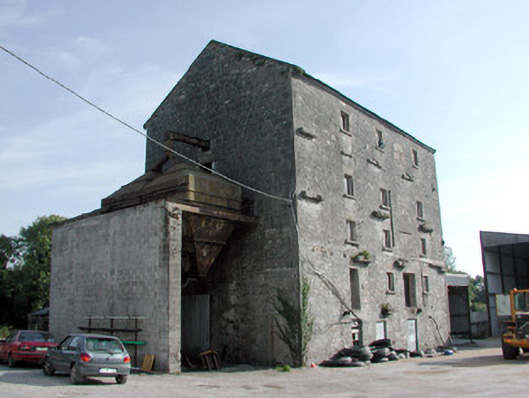 mill (water)mill (water) · 209 yd
 Embanked enclosureFairy fort / earthen ringfort · 1743 yd
 CastleCastle, unclassified · 1.0 mi
 Diarmad and Grainne's BedArchaeological place · 1.1 mi
 Sally IslandIslet · 3.4 mi
 Roscommon CastleCastle · 4.2 mi
 Mount MaryMountain / peak · 5.2 mi
 Site of Killomaine Grave YardArchaeological place · 7.0 mi