What is recorded here
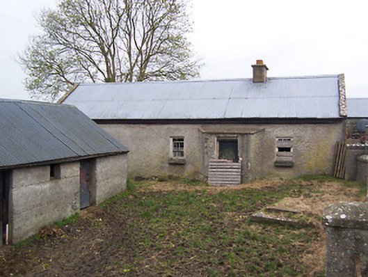
Detached four-bay single-storey house with attic level, built c.1820, having a single-bay entrance porch (on curved plan) offset to the north side of the front side (east). Lobby-entry plan. Now out of use. Pitched corrugated metal roof with raised rendered verges to either end (north and south) and with a single rendered chimneystack above the projecting porch. Lime roughcast rendered walls having square-headed window openings with remains of multi-pane timber sliding sash windows. Square-headed doorcase to porch having a timber sheeted door. Set back from road at a right-angle to the road alignment. Single-storey outbuilding to the southeast. Located to the southwest of Castletown Geoghegan.
A good quality vernacular house, once thatched, which survives with most of its historic qualities intact despite its now sadly dilapidated condition. This building represents a classic example of the typical midland single-storey vernacular house, complete with lobby porch. Buildings of this type were once extremely common but are now very rare survivals. The projecting porch with its sloping roof now sits slightly awkwardly to the entrance front but would have been originally covered by the thatched roof. This building is set at a right-angle to the road alignment, a common feature of vernacular buildings in Ireland. This vernacular house is an excellent example of its type and is a worthy addition to the built heritage of Westmeath.
This does not grant access. Most recorded buildings are privately owned; view them only from public ground unless the owner allows entry.
Places near here
 OutlinedChurch · 1253 yd
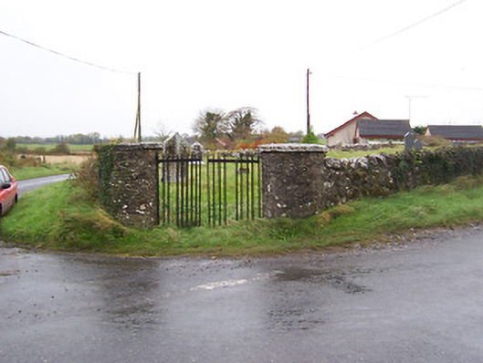 Balrath Graveyardgates/railings/walls · 1290 yd
 Partially hachuredFairy fort / earthen ringfort · 1417 yd
 Balrath CastleCastle · 1609 yd
 Enclosure in Balrath (moycashel By.)Enclosure · 1630 yd
 Killalea FortCastle, motte · 1.3 mi
 Bonfire HillMountain / peak · 3.9 mi
 Ardan WoodWood · 4.1 mi
 Kilmalady HillMountain / peak · 4.3 mi
 High WoodWood · 5.1 mi
 Clara Bog BoardwalkHeritage attraction · 7.7 mi
 Grand Canal WayWalking route · 8.6 mi
Other information
Photo: National Inventory of Architectural Heritage · Website use allowed for educational or private purposes with source credit