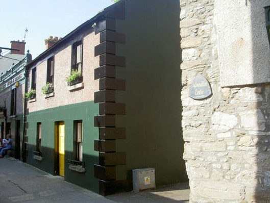
What is recorded here
Corner-sited attached three-bay three-storey house, built c. 1760. Rectangular-plan, return and extensions to east, attached to house to north. Pitched slate roof, clay ridge tiles, painted smooth rendered ruled-and-lined flat-capped chimneystack, verge coping, cast-iron gutters on corbelled eaves course. Painted…
Read the whole record
From the Buildings of Ireland (National Inventory of Architectural Heritage) record 13825046
Places near here
Photo credits
- National Inventory of Architectural Heritage
- Garry Dickinson, Geograph · CC BY-SA 2.0
- Norman McMullan, Geograph · CC BY-SA 2.0
- Darcydwyer, Wikimedia Commons · CC BY-SA 4.0
- Eric Jones, Geograph · CC BY-SA 2.0
- jai, Wikimedia Commons · CC BY-SA 2.0
- Maker not stated on source page, commons.wikimedia.org
- Maker not stated on source page, monumentalireland.ie
 The Anchor BarHouse · 11 yd
Explorer Tom The Anchor Bar thinks the road leading to it is a total diva who refuses to cooperate with anyone else. It keeps its…
 CastleCastle, tower house · 18 yd
Explorer Tom Castle in Liberties of Carlingford bragged it survived a massive storm, but honestly, it looks like it just dodged one.…
 Taaffe's CastleCastle · 69 yd
Explorer Tom Taaffe's Castle near Carlingford is famous for having walls thick enough to stop gossip from getting in or out at all.…
 Town GateHeritage attraction · 72 yd
Explorer Tom Town Gate’s least favourite visitor is definitely the guy who tries to take selfies under it without looking like he…
The TholselTown/city walls · 73 ydExplorer Tom The Tholsel thinks the road leading to it is too slow, but it’s been watching cars pass since the medieval days. Lord…
 TholselGatehouse · 73 yd
Explorer Tom Tholsel in Carlingford is a gatehouse that lost its top floor, making it look perpetually shrunk or slightly…
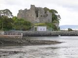 Carlingford CastleHeritage attraction · 357 yd
Explorer Tom Carlingford Castle has King John's name attached, though I suspect Hugh de Lacy would like a word about the building…
 Carlingford - Loop 1A- Commons LoopWalking route · 546 yd
Explorer Tom Carlingford - Loop 1A- Commons Loop in County Louth would survive a zombie attack by hiding behind its overgrown bushes…
 Mapped cemeteryCemetery · 1100 yd
Explorer Tom Mapped cemetery in County Louth describes itself as 'a bit of a mess' if you ask it nicely over a fence. It’s not…
 Carlingford - Slieve Foye LoopWalking route · 1285 yd
Explorer Tom Carlingford - Slieve Foye Loop in County Louth bragged about surviving a storm that flattened three hedges and one…
 Fairy fort / earthen ringfort in Liberties of CarlingfordFairy fort / earthen ringfort · 1397 yd
Explorer Tom This other Fairy fort / earthen ringfort in Liberties Of Carlingford has a hidden message written in its stones if you…
 BarnavaveMountain / peak · 1.1 mi
Explorer Tom Barnavave would tell you in a job interview that it has excellent stability skills because it hasn't moved an inch…
More historic places in County Louth · All of County Louth

What do you know about this place?Tap to add a comment or ask a question