Places near here
Photo credits
- National Inventory of Architectural Heritage
- Eric Jones, Geograph · Creative Commons Attribution-ShareAlike 2.0
- Cathar11, Wikimedia Commons · CC0
- Kieran Campbell, Geograph · CC BY-SA 2.0
- Eric Jones, Geograph · CC BY-SA 2.0
- Eric Jones, Wikimedia Commons · CC BY-SA 2.0
 bridge845 yd
Explorer Tom Bridge in Kednaminsha has a brick vault so impressive it makes me question my own engineering degree. Legend says a goat once ruled this bridge with an iron hoof, and honestly, I believe it. Go with someone who loves old stone, or you’ll just get lonely out there.
 Catholic Church of Mary Mother of MercyChurch/chapel · 1035 yd
Explorer Tom Catholic Church of Mary Mother of Mercy thinks modern buildings are just lazy rectangles with no soul. Its curved walls hug the landscape like they’re trying to hide from the noise. Perfect detox spot if you need to stop judging your own life choices.
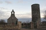 Round Tower1582 yd
Explorer Tom Round Tower in Inishkeen Glebe was built after a suspicious bargain involving a goat and a very confused landlord. It’s got a doorway high enough to keep out short skeptics. Have a sandwich here and call it a heritage lunch.
 Mannan CastleArchaeological place · 4.3 miMannan Castle (in ruins)Castle, Anglo-Norman masonry castle · 4.4 mi
 Promontory fortPromontory fort, inland · 4.9 mi
Explorer Tom Promontory fort in Slieve has had so many former names it’s lost count and just goes by 'that hill.' It’s an oval area on a ridge and thinks it’s mysterious. Stand back, squint, and it looks like a castle.
 Ballsmill Amenity LandPicnic place · 6.2 mi
Explorer Tom Ballsmill Amenity Land in County Armagh is where the wind has a personal grudge against everyone who brings a frisbee, probably because it lost a bet to the river last century. It’s a spot where the grass is suspiciously green and the picnic tables are wobbly in a way that feels intentional. Find the wonkiest bit and send it to your group chat.
 Dundalk CentralHeritage attraction · 7.4 mi
 Irish Hunger StrikersMemorial · 7.5 mi
Explorer Tom Irish Hunger Strikers memorial at New Roads Crossroads is a rock that stands firm because it refuses to take the shortcut of being ignored. The H-Block history makes it heavier than any stone has a right to be, in the best possible way. Give it a pat on the way past, it's had a long life.
 Urney GraveyardGraveyard · 7.7 mi
 Mass Rock Loop TrailWalking route · 8.1 mi
Explorer Tom Mass Rock Loop Trail is named after a rock that apparently held a mass, which sounds like a lot of pressure for a piece of stone. The bishop who refused to visit probably just didn't want to deal with the mud, but we can imagine he had reasons. Have a look and decide if I was lying about the holy vibes.
 CroslieveMountain / peak · 8.1 mi
Explorer Tom Croslieve is playing hard to get, sitting at three-sixty metres with an old comms mast cable making it look like a fancy chandelier. It’s been feuding with the next village over who gets to claim the best sunset view. Hang around long enough and you'll hear a story from a local.
More historic places in County Monaghan · All of County Monaghan

What do you know about this place?Tap to add a comment or ask a question