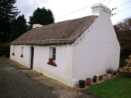
What is recorded here
Detached four-bay single-storey vernacular house, built c. 1820. Still occupied. Pitched rope-and-peg thatched roof having two limewashed chimneystacks (on to the south-east gable end and one to the north-west side of centre) with stepped coping and with metal pegs below eaves (for securing ropes over thatch).…
Read the whole record
From the Buildings of Ireland (National Inventory of Architectural Heritage) record 40908302
Places near here
Photo credits
- louise price, Geograph · CC BY-SA 2.0
- louise price, Wikimedia Commons · CC BY-SA 2.0
- Maker not stated on source page, www.pinterest.com
- louise price, Geograph · Creative Commons Attribution-ShareAlike 2.0
- National Inventory of Architectural Heritage
- Maker not stated on source page, pxhere.com
- Maker not stated on source page, commons.wikimedia.org
 Binn BhánMountain / peak · 1.1 mi
Explorer Tom Binn Bhán is recorded as a mountain / peak in County Donegal. It is hilarious that the ground goes from boggy to…
 Killin HillMountain / peak · 1.5 mi
Explorer Tom Killin Hill sits in County Donegal, recorded as a peak with access details that remain completely unknown. The caption…
 Tullytrasna Standing StonePublicly named standing stone · 1.9 mi
Explorer Tom Tullytrasna Standing Stone is probably just one very tall rock that forgot to sit down. It looks like it’s straining…
 Cloghbrack Burial Ground and Stone CircleBurial ground · 1.9 mi
Explorer Tom Cloghbrack Burial Ground and Stone Circle is a bit of a mess, with only nine stones surviving on the north and east…
 Carraduffy / Killin Court TombCourt tomb · 2.1 mi
Explorer Tom Carraduffy / Killin Court Tomb is mostly a grassy hump with one solitary upright stone standing guard. The rest was…
 Cloghmeen HillMountain / peak · 2.2 mi
Explorer Tom Cloghmeen Hill is having a quiet rivalry with Slieve League because it’s tired of being the understudy in every photo…
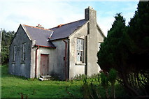 Lettermore National SchoolSchool · 2.2 mi
Explorer Tom Lettermore National School is where a teacher once smuggled a whole crate of chocolates using a hollowed-out textbook.…
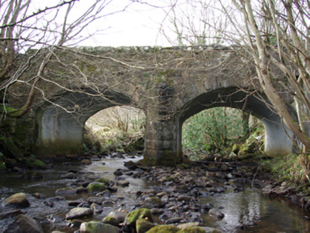 Lettermore BridgeBridge · 2.3 mi
Explorer Tom Lettermore Bridge points a V-shaped stone cutwater into the Eanybeg Water. Built around 1860, it looks like the bridge…
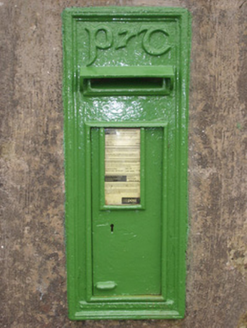 post box3.5 mi
Explorer Tom Post box in Croagh is secretly proud of the potato it once contained, which was actually just a mistake. The Gaelic…
 bridge3.7 mi
Explorer Tom Bridge in Drummacacullen has this chunky V-shaped stone nose sticking out into the Eany Water. Built around 1800, I…
 Gortnacart Glebe Stone Setting / Possible TombMegalithic tomb · 3.8 mi
Explorer Tom Gortnacart Glebe Stone Setting / Possible Tomb is just a dozen stones poking out of the bog, forming an incomplete…
 O'Neils PubPub · 4.3 mi
Explorer Tom O'Neils Pub in County Donegal is probably full of people talking about the weather. No address provided, so it might be…
More historic places in County Donegal · All of County Donegal

What do you know about this place?Tap to add a comment or ask a question