
What is recorded here
Double-arched road bridge over a tributary of the Eany Water River, built c. 1800, having V-profile cut stone/squared rubble stone cutwater to central pier. Segmental-headed arches having dressed voussoirs to arch; squared rubble stone construction to arch barrels. Uncoursed/randomly coursed rubble stone masonry to spandrels and parapets with rock-faced coping over parapets. Rubble stone wing walls to end of parapets; wing walls step outwards to either end of bridge. Tarmacadam deck with grass verges. Located to the north of Inver and to the north-west of Mountcharles.
This double-arched road bridge retains its early character and form, and is an appealing feature in the scenic landscape to the north of Inver. It is robustly-constructed in local rubble stone masonry, and its continued survival and use stands as testament to the quality of its original construction, and of the skill of the masons involved. The good quality dressed stone voussoirs to the arches and the ashlar construction to the cutwaters are of a high standard, which helps to elevate this bridge above many of its contemporaries in Donegal. The wing walls that step outwards in plan are a feature of many bridges in Donegal. This bridge probably originally dates to the late-eighteenth century or the start the nineteenth-century, a period that saw a great deal of road and bridge-building in Ireland, particularly by the Grand Juries (the forerunners of the County Councils). The rock-faced coping over the parapets is a feature of many bridges built or altered by the Board of Works in Ireland during the mid-to-late nineteenth century, which hints that this bridge have been altered c. 1860. This fine rustic bridge is a good example of its type and date, and is an integral element of the built heritage and transport/engineering history of the local area.
From the Buildings of Ireland (National Inventory of Architectural Heritage) record 40909219
This does not grant access. Most recorded buildings are privately owned; view them only from public ground unless the owner allows entry.
Places near here
Photo credits
- National Inventory of Architectural Heritage
- louise price, Geograph · CC BY-SA 2.0
- louise price, Wikimedia Commons · CC BY-SA 2.0
- EecherplazGinkgo06.jpg : Cayambe derivative work: Ginkgotree ( talk ), Wikimedia Commons · CC BY-SA 3.0
- Ronnie Nijboer, Wikimedia Commons · CC0
- Kenneth Allen, Wikimedia Commons · CC BY-SA 2.0
- Kenneth Allen, Geograph · CC BY-SA 2.0
- David Dixon, Wikimedia Commons · CC BY-SA 2.0
 bridge1245 yd
 water tower1251 yd
 Drumlaghtafin HillMountain / peak · 1257 yd
 Carraduffy / Killin Court TombCourt tomb · 1.7 mi
 Killin HillMountain / peak · 2.3 mi
 Tullytrasna Standing StonePublicly named standing stone · 3.4 mi
 Ginkgo4.3 mi
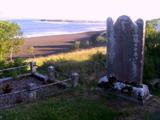 Killymard Old Church GraveyardGraveyard · 4.5 mi
 Wych Elm4.9 mi
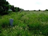 Killaghtee Old Church GraveyardGraveyard · 5.1 mi
 MurvaghOfficial bathing water · 6.1 mi
 Rashenny PointHeadland · 7.2 mi
More historic places in County Donegal · All of County Donegal
What do you know about this place?