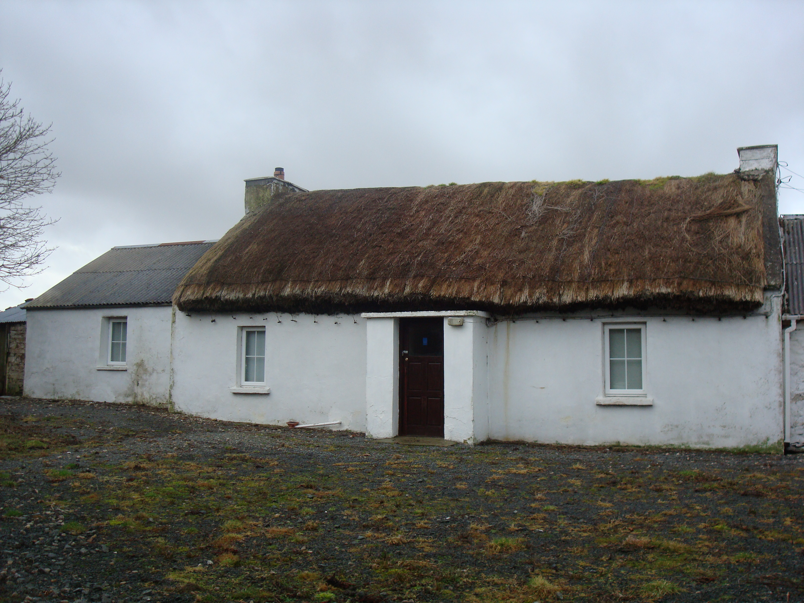
What is recorded here
Detached three-bay single-storey vernacular house, built c.1860, having windbreak entrance to front, single-bay single-storey addition to south gable, and adjoining two-bay single-storey outbuilding attached to north end. Pitched thatched roof to main block, with rendered copings, and rendered chimneystacks to gables,…
Read the whole record
From the Buildings of Ireland (National Inventory of Architectural Heritage) record 40901832
Places near here
Photo credits
- Kenneth Allen, Geograph · CC BY-SA 2.0
- Rossographer, Geograph · CC BY-SA 2.0
- Richard Webb, Wikimedia Commons · CC BY-SA 2.0
- Maker not stated on source page, commons.wikimedia.org
- Golfing in Ireland; photographer not stated, Source publisher
- National Inventory of Architectural Heritage
- Maker not stated on source page, en.wikipedia.org
- Maker not stated on source page, www.tripadvisor.com
- Michael Murtagh, Geograph · CC BY-SA 2.0
- Maker not stated on source page, www.rte.ie
- Maker not stated on source page, www.pinterest.com
 PortsalonOfficial bathing water · 532 yd
Explorer Tom Portsalon has a beach so gracefully curved that it looks as if Lough Swilly used a compass and then showed off.…
 Wild Atlantic Way:Ballymastocker StrandVisitor information · 970 yd
Explorer Tom Wild Atlantic Way:Ballymastocker Strand in County Donegal would post on social media that it’s 'too majestic for your…
 Ballymastocker StrandViewpoint · 971 yd
Explorer Tom Ballymastocker Strand Viewpoint would bring a very aggressive bag of crisps and a blanket with no pattern to any party…
 Killavee Burial GroundBurial ground · 1599 yd
Explorer Tom Killavee Burial Ground is buried under heavy overgrowth on the edge of the sand hills behind Stocker Strand. Davies saw…
 Portsalon Golf ClubGolf course · 1.1 mi
 GreenfortWalled garden · 1.1 mi
Explorer Tom Greenfort's walled garden was built around 1830, with a central hedge, a kitchen garden and a garden temple. I thought…
 Bunnaton Burial Ground for Drowned StrangersBurial ground · 1.3 mi
Explorer Tom Bunnaton Burial Ground for Drowned Strangers is a spot where outsiders who washed up in the sea were laid to rest. The…
 Gullion Burial GroundBurial ground · 1.4 mi
Explorer Tom Gullion Burial Ground is currently hiding in the woods, which is perfect for spooky stories. All you’ve got is a…
 Knockalla FortMartello tower and coastal battery · 1.4 mi
Explorer Tom Knockalla Fort guarded the Donegal coast and Lough Swilly during the Napoleonic Wars. Its building record describes a…
 Knockalla Coastguard StationCoastguard station · 1.5 mi
Explorer Tom Knockalla Coastguard Station is wearing tiny stone teeth on its face like a very confused medieval dragon. I picture…
 Páirc Uí Shiadhail, Fanad Gaels GAAGAA ground · 1.6 mi
 Mapped graveyardGraveyard · 2.0 mi
Explorer Tom Mapped graveyard in County Donegal is locked in a bitter feud with the rain because it keeps washing its paint off…
More historic places in County Donegal · All of County Donegal

What do you know about this place?Tap to add a comment or ask a question