Places near here
Photo credits
- Kenneth Allen, Geograph · CC BY-SA 2.0
- National Inventory of Architectural Heritage
- Dean Molyneaux, Geograph · CC BY-SA 2.0
- Jonathan Wilkins, Wikimedia Commons · CC BY-SA 2.0
- louise price, Wikimedia Commons · CC BY-SA 2.0
- Didier Descouens, Wikimedia Commons · CC BY-SA 4.0
- Kay Atherton, Geograph · CC BY-SA 2.0
- Kenneth Allen, Wikimedia Commons · CC BY-SA 2.0
 St. John's Church of Ireland ChurchChurch/chapel · 1124 yd
Explorer Tom St. John's Church of Ireland in Killinangel Beg is a simple hall-type church from the early 1800s with a muted Gothic Revival look. The cut stone bellcote has an unusual fleur-de-lis design on it, which is quite cool. It’s just a mile from the beach!
 bridge1209 yd
Explorer Tom Bridge in Killinangel Beg held a road over the old Donegal Town to Ballyshannon railway. Its arch has gently rough-faced stones, and the tracks were removed around 1960. I would give each stone a train whistle to practise with, but the real line has gone quiet.
 RossnowlaghOfficial bathing water · 1.1 mi
Explorer Tom Rossnowlagh seems determined to be a whole journey rather than one beach. Donegal tourism runs it from Coolmore’s cliffs to Carrickfad’s rock. I would need a bigger postcard for that stretch of golden sand; the surfers have probably had that problem for years.
 Sheebarran RingfortFairy fort / earthen ringfort · 2.3 mi
Explorer Tom Sheebarran Ringfort is a massive circular space with a ditch so wide it could swallow a small car. It sits on the crest of a ridge with excellent views, making it the perfect spot for a dare to see how far you can shout. Use it as a yarn about being the king of the hill without actually wearing a crown.
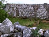 Kilbarron Old Church GraveyardGraveyard · 2.6 mi
Explorer Tom Kilbarron Old Church Graveyard features a 15th or 16th century ruin with a 2.4m high E gable that has no window at all. That is quite the dramatic lighting choice for a place meant to let in some divine brightness.
 Hawthorn2.8 mi
Explorer Tom Hawthorn in County Donegal is having a bit of a tantrum about needing permission to be seen. I'm told it's fancy stuff, but honestly, just hugging it might scare the locals off. Give it a wink for me.
 Dark Cliffs at KilbarronPublicly named cliff or headland · 3.0 mi
Explorer Tom Dark Cliffs at Kilbarron sound like a gothic novel title written by a depressed teenager. They’re brooding, moody, and probably judging your photography skills. Snap one photo, then put the phone away and actually look.
 Kilbarron Castle in ruinsCastle, tower house · 3.0 mi
Explorer Tom Kilbarron Castle in ruins clings to a precipitous promontory, where the O'Clerys rebuilt their stronghold after 1390. I love that trace of an underground passage, though it’s blocked up now. It’s basically a cliff-edge mystery with some very stubborn stone footing.
 MurvaghOfficial bathing water · 3.0 mi
Explorer Tom Murvagh Beach has a wartime lookout hut that Joy Browne, writing for Donegal tourism, remembers playing in as a child. She says erosion has since sunk it into the sand and made entry impossible. A lookout hut retiring by burying its feet is theatrical enough for me; I would leave it to its rest.
 Creevy Pier HotelHotel · 3.4 mi
Explorer Tom Creevy Pier Hotel suggests you're staying on a pier that might wobble dangerously in high tide, with the 'hotel' part doing heavy lifting. It’s basically a restaurant pretending to be accommodation, so don't trust the balcony too much. Bring your nan, she'll know more than me.
 McGinley's BarPub · 4.2 mi
Explorer Tom McGinley’s Bar is on Bishop Street, so maybe bring your prayers just in case something weird happens over there. Order something with a name longer than three words and see if they can even spell it correctly. If anyone asks, Tom sent you.
 Standing stone in Townparks (ballyshannon Ed)Standing stone · 4.2 mi
Explorer Tom Standing stone in Townparks is roughly 1.3m high and set on rock outcrop, possibly just a natural feature rather than a true standing stone. Locals say it marks a fording place of the river Erne, but with 'cat's paw' markings that might be natural too, it’s hard to know if it’s a guide or just a grumpy rock.
More historic places in County Donegal · All of County Donegal

What do you know about this place?Tap to add a comment or ask a question