
Places near here
Photo credits
- National Inventory of Architectural Heritage
- Frabjousone, Wikimedia Commons · CC BY-SA 4.0
- Mike Searle, Wikimedia Commons · CC BY-SA 2.0
- Mike Searle, Geograph · CC BY-SA 2.0
- dougf, Geograph · CC BY-SA 2.0
- Gordon Hatton, Wikimedia Commons · CC BY-SA 2.0
- El Gringo ( talk ) ( Uploads ), Wikimedia Commons · CC BY-SA 3.0
- Maker named on the Wikimedia Commons picture page · CC BY-SA 2.5
- me, Wikimedia Commons · Public domain
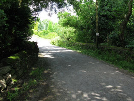 Ahadine BridgeBridge · 1079 yd
Explorer Tom Ahadine Bridge in Sranaviddoge hears every whisper from the river below, including the one where someone dropped their lucky coin last Tuesday. The masonry is solid enough to hold a grudge for decades, so tread lightly and don’t lean on it. Shout 'hello' if you want to hear an echo.
 farm house1163 yd
Explorer Tom Farm house in Tullyglass is holding up because it’s too proud to fall down, even though it’s seen better days. It’s got those timber sash windows and slate roofs that scream 'prosperous nineteenth century.' Get there early before the cows decide they’re in charge of the gate again.
Green HillMountain / peak · 2.7 miExplorer Tom Green Hill must have been built using an obscene amount of tea, probably ten thousand cups to keep it green enough to look so fresh. It’s got that perpetually caffeinated vibe where it never seems to stop being vibrant. Just take a good look and see if I’m exaggerating its coffee-fueled glory.
 Michael Collins MemorialMemorial · 3.7 mi
Explorer Tom Michael Collins Memorial in County Cork is definitely the shortcut that is actually a dead end. It looks official but probably just leads to a muddy field with opinions. Wave at the cows, they are the real locals.
 Cloigtheach (Round Tower)Round tower · 4.0 mi
Explorer Tom Cloigtheach in Sleenoge has a unique hexagonal base that makes it look like it was built by someone who really liked geometry. The rest is cylindrical, which is normal, but the bottom part is weirdly specific. Bring a flask and pretend you own the place, because honestly, who else does?
 Fort RobertArchaeological place · 4.8 mi
Explorer Tom Fort Robert is an archaeological site where a prophecy said a dragon would land here in 1994, but it never did and everyone just forgot about it afterwards without making a fuss. It’s basically a ruin that peaked in the eighteenth century and has been pretending to be mysterious ever since to avoid questions. Bring biscuits, every good story needs biscuits.
 Tower (in Ruins)Bawn · 7.5 mi
Explorer Tom Tower in Ballynacarriga is just fragmentary bawn remains next to the main castle. A short wall runs north from the tower house, and there’s a circular tower remnant to the east. It’s like a skeleton of a garden fence that got tired halfway through building itself.
 Ballynacarriga CastleCastle, tower house · 7.6 mi
Explorer Tom Ballynacarriga Castle is a four-storey tower house overlooking the lough. It has a spiral stair, vaulted lobby, and murder hole. The top floor was used as a chapel later on. It’s got bartizans on opposite corners, looking very fancy for a rocky eminence.
 Kilmichael Ambush SiteMonument · 8.3 mi
Explorer Tom Kilmichael Ambush Site in County Cork has a rivalry with every other ambush site because they all think theirs was the cleverest one ever pulled off. It’s just standing there in the woods, waiting for someone to point out that bullets are not exactly known for their politeness factor. Perfect spot to practise your best tour-guide voice.
 Kilmichael AmbushAmbush · 8.3 mi
Explorer Tom The Kilmichael Ambush has a secret talent for making you feel like you’re walking through a very aggressive history book that keeps popping up in your peripheral vision to check if you’re paying attention. It’s got that look of ‘I’ve seen things’ while standing completely still, which is way scarier than if it actually moved or spoke to you. Count the crows, then count again.
 Sessile Oak9.6 mi
Explorer Tom Sessile Oak in County Cork would post on social media: 'Another day, another leaf falling. #NatureIsIndifferent.' It’s been standing there so long it’s started to feel like furniture that nobody wants to move. The bark is thick enough to hide a secret or two. Ring your granny and tell her where you are.
 The Gearagh Nature ReserveNature reserve · 9.6 mi
Explorer Tom The Gearagh Nature Reserve remembers the time a priest lost a bet there and had to wear a penguin suit for a week, which was undignified. The reeds are still giggling about it. Take a mate and argue about what it was for.
More historic places in County Cork · All of County Cork

What do you know about this place?Tap to add a comment or ask a question