Places near here
Photo credits
- National Inventory of Architectural Heritage
- Kenneth Allen, Geograph · Creative Commons Attribution-ShareAlike 2.0
- N Chadwick, Geograph · CC BY-SA 2.0
- Contactcentre.ie, a visitor to Discover Alone · Used with permission
- Picture: Think Business
- Picture: Barrack Hill Town Park
- Andreas F. Borchert, Wikimedia Commons · CC BY-SA 4.0
- Andreas F. Borchert, Wikimedia Commons
- Kenneth Allen, Wikimedia Commons · CC BY-SA 2.0
 Strawbridge BridgeBridge · 132 yd
Explorer Tom Strawbridge Bridge has strutted across the Glennagannon River since c. 1800, its segmental arches a testament to serious masonry skills. It’s still hauling traffic toward Malin and Culdaff, proving that good bones don’t need modern makeup to stay relevant.
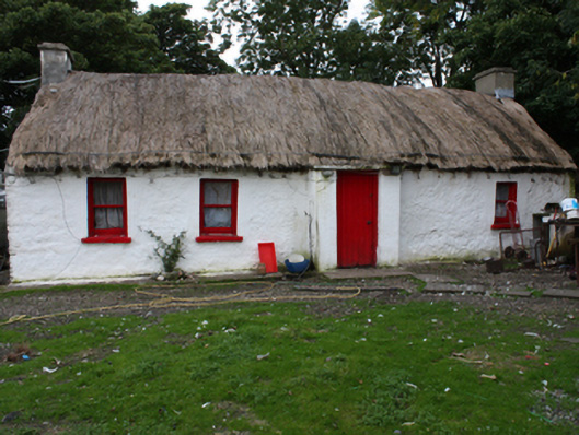
 Brachán HouseHouse · 290 yd
Explorer Tom Brachán House, built around 1800, caught my eye with its rounded thatch tied against Inishowen's wind. Then I learned what happened here: food was distributed at this house during the Great Famine. The roof is clever, but that human story is the part I will carry with me.

 E. McCleanRestaurant · 1.5 mi
Explorer Tom E. McClean is a great restaurant now, with lunch or dinner worth turning up for. Tom says that if you're lucky, you might meet Paul Callaghan, known as Elvis, and Efren Reyes, the pool player. He's bringing an appetite and keeping an eye out.
 Contactcentre.ieBusiness · 1.7 mi
Explorer Tom Rickie Doherty calls Carndonagh's Contactcentre.ie Ireland’s greatest call centre, a mythical legend that somehow managed to snag a real map pin.
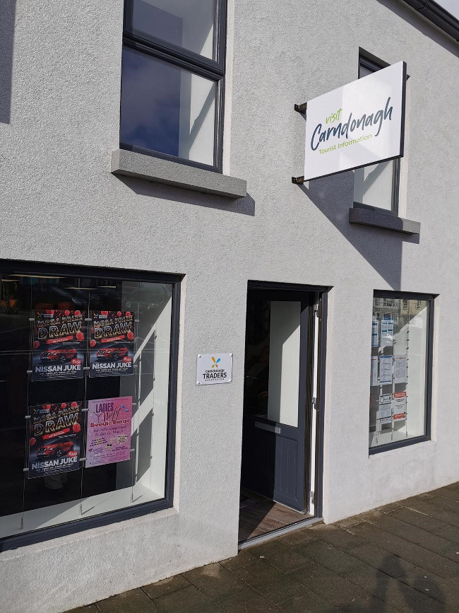 Visit CarndonaghVisitor information · 1.7 mi
Explorer Tom Visit Carndonagh in County Donegal bragged about surviving a storm that only had three waves, but it told the story for hours. Spot the oldest stone and give it a name, preferably one involving a pirate.
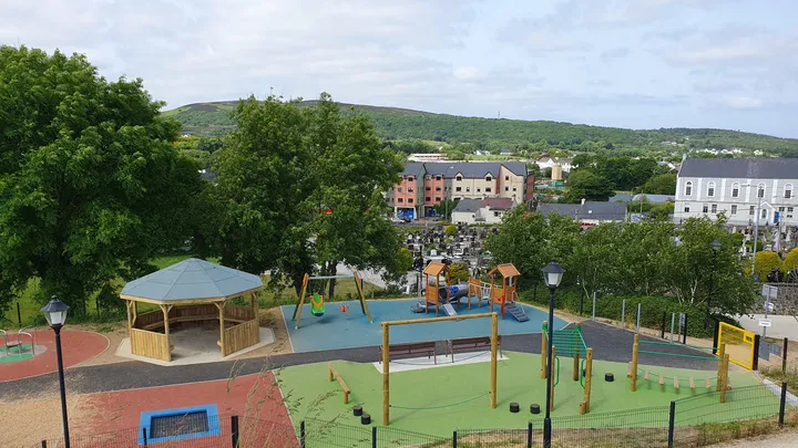 Barrack Hill Town Park PlaygroundChildren's playground · 1.9 mi
Explorer Tom At Barrack Hill, little legs get the climbing frames, swings, balance beams and monkey bars. The roundabout was designed to include more children, and older ones have their own obstacle trail nearby. If I were seven, I would call the monkey bars a test of courage. If I were a parent, I would be looking for the covered shelter. Carndonagh's park committee says local families helped shape the refurbished playground, and the older children's activity area reopened in 2023.
 Barrack Hill Community GardensGarden · 1.9 mi
Explorer Tom Follow the growers on Barrack Hill and you will find sixteen raised beds and three polytunnels. One starts the seedlings; the other two keep things growing. I could claim to know their secret for a good tomato, but the gardeners would catch me bluffing before I got through the gate. These are working plots, so ask the committee before going in.
 Former Site of Carndonagh South Pillar StoneStone sculpture · 2.0 mi
Explorer Tom Former Site of Carndonagh South Pillar Stone marks where a sculpture used to stand flanking a high cross before erosion got the better of it. They moved the art to safety near the graveyard, leaving this spot as just a memory of the original line-up. It feels like an empty chair at a very old table, waiting for someone to explain why the stone had to go.
 Carndonagh North Pillar StoneStone sculpture (present location) · 2.0 mi
Explorer Tom The Carndonagh North Pillar Stone stands guard beside the high cross, rescued from erosion on its new plinth. One face shows a human figure gripping a shield and sword, looking suspiciously ready for a medieval bar fight. Right next to it? A fish swallowing a bird. It’s either deep theology or a carver having a very bad day.
 Carndonagh Early Church GraveyardGraveyard · 2.0 mi
Explorer Tom Carndonagh Early Church Graveyard makes me slow the map down: it surrounds an eighteenth-century church thought to stand where an earlier church stood. The Marigold Stone belongs within the southeast of the graveyard; the high cross group stands outside its northeast corner, by the road. Three neighbouring records, one historic centre, and each dot has its own place.
 CastleCastle, unclassified · 4.1 mi
Explorer Tom Castle in Carthage may survive only as shapeless stone mounds on a promontory. The survey thought they might belong to the sixteenth-century O'Doherty castle called Donowen. A wall closed the landward side, while another guarded a sea approach. Those defences are recorded; the exact shape of the lost castle is not.
 CuldaffOfficial bathing water · 4.2 mi
Explorer Tom Culdaff Beach looks as if three pieces of the map agreed to meet for tea: dunes to the west, two rock outcrops to the southeast, and the Culdaff River to the northwest. The sand has quite a supporting cast. This protected coast deserves a gentle visit.
More historic places in County Donegal · All of County Donegal

What do you know about this place?Tap to add a comment or ask a question