Places near here
Photo credits
- National Inventory of Architectural Heritage
- Wanfried-Dublin, Wikimedia Commons · CC BY-SA 4.0
- Andreas F. Borchert, Wikimedia Commons · CC BY-SA 4.0
- Kenneth Allen, Geograph · CC BY-SA 2.0
- Dr Neil Clifton, Geograph · CC BY-SA 2.0
- Picture: Think Business
- Picture: Barrack Hill Town Park
- michael clarke stuff, Wikimedia Commons · CC BY-SA 2.0
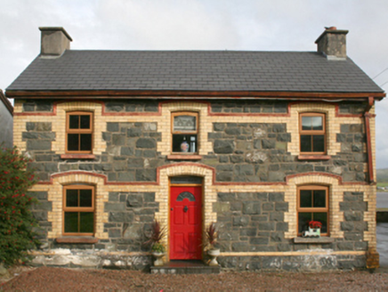 railway station1.5 mi
Explorer Tom This railway station in Rashenny is dressed up in a gorgeous clash of dark stone and bright yellow brick. It served the narrow-gauge line from 1901 until it vanished in 1935, but now it’s just a cosy private home. I bet the ghosts of those steam engines are still checking the doorbell.
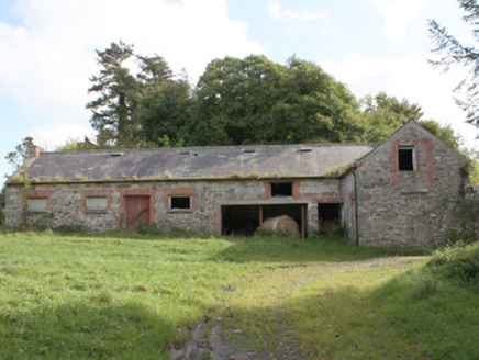 Donagh Church of Ireland RectoryOutbuilding · 1.7 mi
Explorer Tom The Donagh Church of Ireland Rectory outbuildings are solid 1820s masonry, built to last through centuries of weather and worship. You can see why these structures mattered; they were the working heart of the glebe. Stand back and admire those tooled limestone quoins, they’re serious architecture, not just farm fluff.
.jpg/250px-Magheranaul_(3).jpg "Photo: Wanfried-Dublin, Wikimedia Commons · CC BY-SA 4.0") Magheranaul Wedge TombWedge tomb · 2.2 mi
Magheranaul Wedge TombWedge tomb · 2.2 miExplorer Tom Magheranaul Wedge Tomb has a single roofstone covering its gallery, with an hour-glass hole bored right through the closing stone. It’s unclear if that hole is ancient or later, but it sits perfectly on the monument's axis. A real head-scratcher hidden in the pasture.
 Carndonagh Donagh Church Carved LintelArchitectural fragment · 2.5 mi
Explorer Tom Lean in close to this Carndonagh Donagh Church Carved Lintel, as it’s been quietly propped against the church wall for centuries. It features a central wheeled cross with interlacing patterns that look like they’re dancing right off the stone.
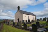 Carndonagh Early Church GraveyardGraveyard · 2.5 mi
Explorer Tom Carndonagh Early Church Graveyard makes me slow the map down: it surrounds an eighteenth-century church thought to stand where an earlier church stood. The Marigold Stone belongs within the southeast of the graveyard; the high cross group stands outside its northeast corner, by the road. Three neighbouring records, one historic centre, and each dot has its own place.
 Nancy's BarnCafé · 2.6 mi
Explorer Tom Nancy's Barn serves fish that looks like it hasn't moved since the Ice Age. It would complain to the council about the cow traffic on Main Street. Spot the oldest stone and give it a name.
 Ballyliffin HotelHotel · 2.8 mi
Explorer Tom Ballyliffin Hotel number one is probably the quiet one next to the church, hiding a love story that went badly wrong. See if you can find a room with a view of nothing but sky for peace. Pack a picnic and an excuse.
 Visit CarndonaghVisitor information · 2.9 mi
Explorer Tom Visit Carndonagh in County Donegal bragged about surviving a storm that only had three waves, but it told the story for hours. Spot the oldest stone and give it a name, preferably one involving a pirate.
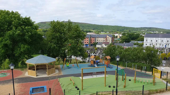 Barrack Hill Town Park PlaygroundChildren's playground · 3.0 mi
Explorer Tom At Barrack Hill, little legs get the climbing frames, swings, balance beams and monkey bars. The roundabout was designed to include more children, and older ones have their own obstacle trail nearby. If I were seven, I would call the monkey bars a test of courage. If I were a parent, I would be looking for the covered shelter. Carndonagh's park committee says local families helped shape the refurbished playground, and the older children's activity area reopened in 2023.
 Barrack Hill Town ParkPark · 3.0 mi
Explorer Tom Barrack Hill gives Carndonagh more than a bench and a patch of grass. Follow the paths past the playground and up towards the metal heads watching the town. The community gardens have raised beds and polytunnels for people who prefer their adventures with a trowel. Local volunteers help keep the whole place going, and this hill has enough in it to make a quick lap turn into a proper wander.
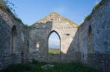 Clonmany Early Church GraveyardGraveyard · 3.8 mi
Explorer Tom Clonmany Early Church Graveyard hides a stone with two cupmarks called St. Colmcille's knee-prints. I reckon a kneeling saint would need much larger knees to leave that kind of impression, but tradition is a stubborn thing.
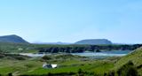 Five Finger StrandBeach / strand · 3.9 mi
Explorer Tom Five Finger Strand is all wild sand dunes and rocky fingers reaching out like a desperate hand for help. It’s the kind of place that makes you feel tiny and gloriously unimportant. Bring a pen pal, they'll be jealous.
More historic places in County Donegal · All of County Donegal

What do you know about this place?Tap to add a comment or ask a question