
What is recorded here
From the National Monuments Service (Archaeological Survey of Ireland) record CO072-045
Places near here
Photo credits
- Maker not stated on source page, www.pinterest.com
- Maker not stated on source page, it.pinterest.com
- National Inventory of Architectural Heritage
- Maker not stated on source page, vec.advisor.travel
- Maker not stated on source page, www.flickr.com
- Maker not stated on source page, www.irishexaminer.com
- Maker not stated on source page, 2pos.irish
- Algirdas at Lithuanian Wikipedia, Wikimedia Commons · Public domain
- Maker not stated on source page, uk.pinterest.com
 2018 Drought Shoreline endBeach / strand · 293 yd
Explorer Tom 2018 Drought Shoreline end would use its lotto win to buy a bigger hat and ignore everyone asking why it looks dry.…
 Fairy fort / earthen ringfort in Walshestown (muskerry East By.)Fairy fort / earthen ringfort · 1225 yd
Explorer Tom Fairy fort / earthen ringfort in Walshestown has cattle trampling its soul out. There’s a hole in the bank where they…
 Clashanure HouseCountry house · 1257 yd
Explorer Tom Clashanure House is all about symmetry and order, with slate roofs that look like they’re ready for a very fancy…
 Bullaun stone in FahaBullaun stone · 1391 yd
Explorer Tom Bullaun stone in Faha looks like a giant pancake with a hole in the middle, probably for letting ghosts out. It’s…
 Castle Inch (in Ruins)Bawn · 1.0 mi
Explorer Tom Castle Inch Bawn in Castleinch, County Cork was forcibly taken by Mac Carthys back in 1593, which sounds like a very…
 Valley View HouseHouse · 1.6 mi
Explorer Tom Valley View House is showing off its oriel window in Lackenareague. From around 1910, it’s got that Arts and Crafts…
 Inniscarra Hydro Electric Power StationDam/reservoir/basin · 1.6 mi
Explorer Tom Inniscarra Hydro Electric Power Station in Curraleigh has strict rules that say no one can enter without a helmet, a…
 Inniscarra GAA pitchGAA ground · 1.9 mi
 Srelane HouseHouse · 1.9 mi
Explorer Tom Srelane House is a classically inspired L-plan house from around 1910 with paired central chimneystacks that look like…
 Éire Óg GAA pitchGAA ground · 2.4 mi
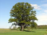 Pedunculate Oak5.2 mi
Explorer Tom Another Pedunculate Oak in County Cork is hiding a scandal from centuries ago that involved a missing hat and a very…
 Castle (in Ruins)Castle, tower house · 5.9 mi
Explorer Tom Castle in Castlemore sits on a limestone outcrop next to a modern quarry dump. The south slope is all collapsed…
More archaeology and monuments in County Cork · All of County Cork

What do you know about this place?Tap to add a comment or ask a question