
What is recorded here
OS 36 (Precise location not known) 58. There is some confusion regarding the location of Ó Muirgheasa No. 66. It proved impossible to discover the location of this holy well. Described by Ó Muirgheasa in 1936 as 'There is a Holy Well, now nameless, in Moyagh, two miles from Milford, and near Tullybeg N. S. Stations…
Read the whole record
From the National Monuments Service (Archaeological Survey of Ireland) record DG036-032
Places near here
Photo credits
- National Inventory of Architectural Heritage
- Kenneth Allen, Wikimedia Commons · CC BY-SA 2.0
- Maker not stated on source page, www.flickr.com
- Maker not stated on source page, en.wikipedia.org
- Maker not stated on source page, www.alamy.com
- Maker not stated on source page, tr.pinterest.com
- Maker not stated on source page, www.dreamstime.com
- Heikki.vesanto, Wikimedia Commons · CC BY-SA 4.0
- Picture: Donegal Day Out
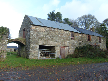 MoyaghOutbuilding · 162 yd
Explorer Tom Moyagh is reciting a terrible poem about its own outbuildings every time the wind blows through the gap between the…
 Aghawoney Standing StonesPublicly named standing stone · 1570 yd
Explorer Tom Aghawoney Standing Stones in Donegal took about four million cups of tea to line up properly, and honestly, I think…
 Stone row in PortleenStone row · 1581 yd
Explorer Tom Stone row in Portleen is just two stones glaring at each other because the third one bailed on them ages ago. They’re…
 Aghawoney High-Banked Fairy FortFairy fort / earthen ringfort · 1.2 mi
Explorer Tom Aghawoney High-Banked Fairy Fort was nearly sold to a farmer for the price of a horse, which says something about its…
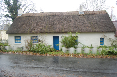 Milestone CottageHouse · 1.4 mi
Explorer Tom Milestone Cottage in Ballyarr Glebe wears a wavy, scalloped thatch on its head from around 2005. It looks like the…
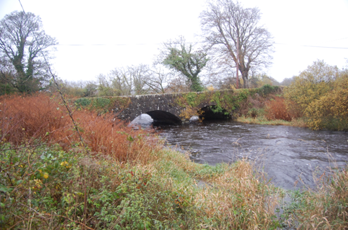 Tully BridgeBridge · 1.4 mi
Explorer Tom Tully Bridge is currently being courted by a very persistent cow who keeps trying to buy it with shiny buttons and a…
 Bullaun stone in Ráith (tc Baile Áir)Bullaun stone · 1.4 mi
Explorer Tom Bullaun stone in Ráith is a rock that got poked so many times it’s starting to look like a cheese! I bet it was used…
 Ballydone BridgeBridge · 1.5 mi
Explorer Tom Ballydone Bridge takes the road over the Lennan River on two arches, built around 1860. A triangular cut-water divides…
 Cill an Leabhair GraveyardGraveyard · 1.5 mi
Explorer Tom Cill an Leabhair Graveyard sits on a rocky wooded slope where the only thing left to read is the soil. It’s called…
 Holy well in Glen LowerHoly well · 1.5 mi
Explorer Tom The Holy well in Glen Lower is part of a vanished complex called Cill an Leabhair, or Church of the Book. No stones…
 Ballyarr Nature ReserveNational nature reserve · 1.7 mi
Explorer Tom Ballyarr Wood has the lovely confidence of a place that does not need a castle, a cliff or a gift shop to make you…
 Drummonaghan WoodForest recreation place · 2.1 mi
Explorer Tom Drummonaghan Wood is only about a kilometre from Ramelton, yet its trees make the busy old town feel a thoughtful…
More archaeology and monuments in County Donegal · All of County Donegal

What do you know about this place?Tap to add a comment or ask a question