What is recorded here
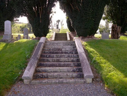
Graveyard and site of Church of Ireland church, dating to 1841, comprising two grassy terraces mounted by flights of cut-stone steps, parapets and landings flanked by mature trees providing access to elevated site of former church and flanked by yew trees, to form yew walk. Concrete represent footprint of church, reflecting buttresses to corners and along nave long walls. Road boundary comprises rubble limestone walls with rubble copings, with decorative cast-iron double-leaf gate between detailed carved stone piers, in turn flanked by matching railings on cut-stone plinth. Hedgerows to north, south and west.
This cemetery with its elevated setting and designed landscape elements has a striking visual impact along the roadside. The yew trees, strongly associated with churchyards and cemeteries, define the pathway on a central axis with the former church. The decorative cut-stone piers provide an eye-catching contrast to the rubble stone boundary wall, and demonstrate highly skilled craftsmanship.
From the Buildings of Ireland (National Inventory of Architectural Heritage) record 41402513
This does not grant access. Most recorded buildings are privately owned; view them only from public ground unless the owner allows entry.
Places near here
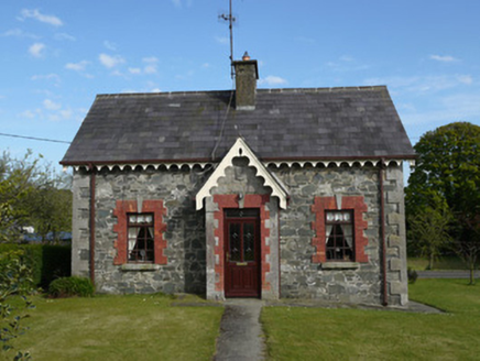 worker's house315 yd
 Saint Patrick's Catholic ChurchChurch/chapel · 366 ydKnockreaghMountain / peak · 1563 yd
 Mannan Castle (in ruins)Castle, Anglo-Norman masonry castle · 3.5 mi
 Crane IslandIsland · 3.6 mi
 Lough MucknoLake and park landscape · 4.0 mi
 Blaney CastleCastle · 4.2 mi
 Battle of Newry RoadBattle · 4.6 mi
 Rath in DrummuckRath · 4.8 mi
 Medieval & post-med. church & graveyard in Creggan Bane GlebeMedieval & Post-med. Church & Graveyard · 5.2 mi
 Crannog in lisleitrim lough in Kiltybane or LisleitrimCrannog in Lisleitrim Lough · 5.3 mi
 Operation ConservationMilitary operation · 6.8 mi
Pictures: National Inventory of Architectural Heritage; Eric Jones, Geograph · Creative Commons Attribution-ShareAlike 2.0; Kieran Campbell, Geograph · CC BY-SA 2.0; Eric Jones, Geograph · CC BY-SA 2.0; Shane Killen, Wikimedia Commons · CC BY-SA 2.0; Dean Molyneaux, Wikimedia Commons · CC BY-SA 2.0; Sgt Jack Pritchard RAF, Wikimedia Commons · OGL v1.0; HENRY CLARK, Geograph · CC BY-SA 2.0; DagosNavy, Wikimedia Commons · CC BY-SA 3.0
More historic places in County Monaghan · All of County Monaghan
What do you know about this place?