
What is recorded here
From the Northern Ireland Sites and Monuments Record record DOW018:043
Places near here
Photo credits
- Maker not stated on source page, www.dreamstime.com
- Maker not stated on source page, www.pinterest.com
- Rossographer, Geograph · CC BY-SA 2.0
- Oliver Dixon, Wikimedia Commons · CC BY-SA 2.0
- Oliver Dixon, Geograph · CC BY-SA 2.0
- Rossographer, Wikimedia Commons · CC BY-SA 2.0
- Dean Molyneaux, Wikimedia Commons · CC BY-SA 2.0
- Aubrey Dale, Wikimedia Commons · CC BY-SA 2.0
- Maker not stated on source page, commons.wikimedia.org
 Medieval (site of) & modern church & graveyard: ballyhalbert in BallyhalbertMedieval (site of) & Modern Church & Graveyard: Ballyhalbert · 31 yd
Explorer Tom Medieval & modern church & graveyard: Ballyhalbert is playing hide-and-seek with me. A tale from 1846 says an earl…
 Standing StoneArchaeological place · 187 yd
Explorer Tom Standing Stone in County Down handles nosey neighbours by simply standing still while they talk, which drives them…
 Windmill HillMountain / peak · 1128 yd
Explorer Tom This Windmill Hill started because two lads made a bet in the pub that they could find a hill with no wind, which…
 Burr PointHeadland · 1672 yd
Explorer Tom Burr Point claims Ireland's easternmost mainland title, and I can already hear Cannon Rock offshore objecting. The…
 Burial IslandIslet · 1.2 mi
Explorer Tom Burial Island in County Down is off Burr Point, which is the easternmost point of Ireland, so it’s basically the edge…
 Glastry Presbyterian ChurchChurch · 1.3 mi
Explorer Tom Glastry Presbyterian Church bragged about surviving a storm that took out the roof of the pub next door but left its…
 Non-subscribing Presbyterian ChurchChurch · 1.4 mi
Explorer Tom Ballyhemlin’s Non-subscribing Presbyterian Church has been standing since the 1820s, looking sharper than your ex. The…
 Graveyard in GlastryGraveyard · 1.8 mi
Explorer Tom Glastry graveyard would tell the place that replaced it to keep out of its way and stop hogging the view. It’s…
 Inishargy BogNature reserve · 2.1 mi
Explorer Tom Inishargy Bog hosted a dance once where the mud got a bit too enthusiastic and swallowed the DJ whole, which is why…
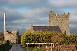 Tower-house and bawn: kirkistown castle in KirkistownTower-house and Bawn: Kirkistown Castle · 3.4 mi
Explorer Tom Kirkistown castle in Kirkistown got lost by the Vikings, who were clearly not great with directions back then. It’s the…
Kirkistown CastleCastle · 3.4 miExplorer Tom Kirkistown Castle is pretending to be from 1500, but I’m calling its bluff; it looks like a weekend DIY project that…
 Kirkistown CemeteryCemetery · 3.4 mi
Explorer Tom Kirkistown Cemetery in County Down is guarding a secret: if you don’t wave to the graves, you’ll trip over your own…
More archaeology and monuments in County Down · All of County Down

What do you know about this place?Tap to add a comment or ask a question