
What is recorded here
From the Northern Ireland Sites and Monuments Record record DOW018:028
Places near here
Photo credits
- Rossographer, Wikimedia Commons · CC BY-SA 2.0
- Dean Molyneaux, www.geograph.ie
- Picture: Sharon Cosgrove
- Rossographer, Geograph · CC BY-SA 2.0
- Maker not stated on source page, commons.wikimedia.org
- Maker not stated on source page, www.slideserve.com
- Kenneth Allen, Geograph · CC BY-SA 2.0
- Maker not stated on source page, www.dreamstime.com
- Eric Jones, Geograph · CC BY-SA 2.0
- Oliver Dixon, commons.wikimedia.org
 Glastry Presbyterian ChurchChurch · 1117 yd
Explorer Tom Glastry Presbyterian Church bragged about surviving a storm that took out the roof of the pub next door but left its…
 McKenna Park, St. Joseph's GAA, BallycranGAA ground · 1197 yd
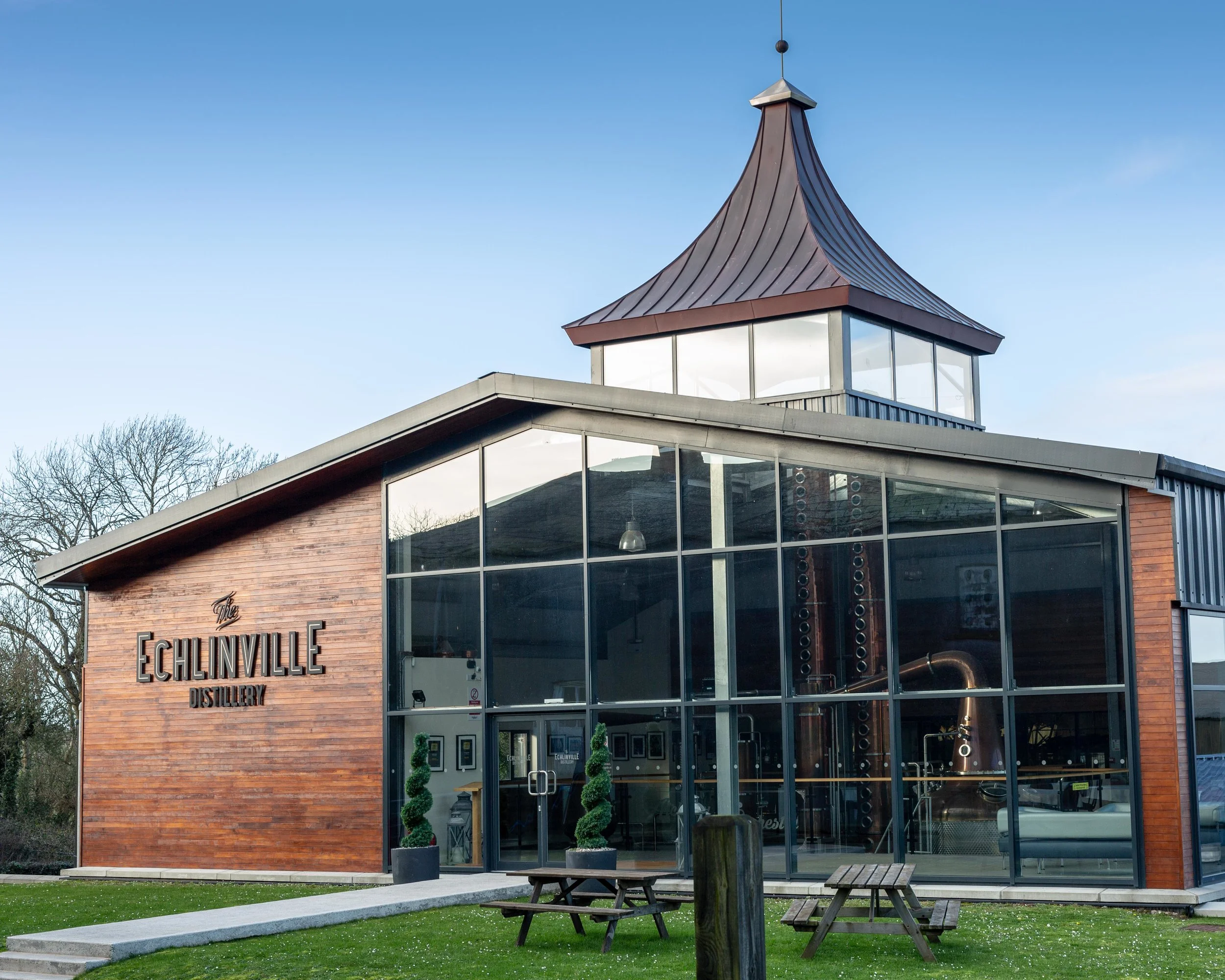 The Echlinville DistilleryHeritage attraction · 1679 yd
Explorer Tom At 62 Gransha Road near Kircubbin, Echlinville Distillery begins its story in the Ards Peninsula fields, where the…
 Windmill HillMountain / peak · 1.1 mi
Explorer Tom This Windmill Hill started because two lads made a bet in the pub that they could find a hill with no wind, which…
 Cairn in RowreaghCairn · 1.4 mi
Explorer Tom Cairn in Rowreagh would cope on a reality show by refusing to speak and just glaring at the cameras for weeks. It’s…
 Sub rectangular enclosure, partially defined by townland boundary and elsewhere as a cropmark in RowreaghSub rectangular enclosure, partially defined by townland boundary and elsewhere as a cropmark · 1.4 mi
Explorer Tom Sub rectangular enclosure in Rowreagh was promised it would become a golf course in the seventies, but the prophecy…
 Cropmark Enclosure in GranshaCropmark Enclosure · 1.6 mi
Explorer Tom Cropmark Enclosure in Gransha thinks its stones are spelling out a secret code that just says 'get lost' in ancient…
 Horse IslandIsland · 1.9 mi
Explorer Tom Horse Island in County Down would post on social media about its stunning views and how lucky everyone is to see it…
 Graveyard: lisbane house in LisbaneGraveyard: Lisbane House · 2.6 mi
Explorer Tom Lisbane House graveyard dates back to early Christian times, so it’s seen more zombies than any of us. It’s got ancient…
 Church & Graveyard & Coffin Lids (2): Ardkeen Church in ArdkeenChurch & Graveyard & Coffin Lids (2): Ardkeen Church · 3.5 mi
Explorer Tom Church & Graveyard & Coffin Lids (2): Ardkeen Church in Ardkeen has seagulls who critique its architecture from above…
 Pherson's IslandIsland · 3.7 mi
Explorer Tom Pherson's Island is technically a drumlin that got promoted to island status after the sea level rose, which is like…
 Mitchel Park, John Mitchel's GAA, BallygalgetGAA ground · 4.4 mi
More memorials and graveyards in County Down · All of County Down

What do you know about this place?Tap to add a comment or ask a question