
Places near here
Photo credits
- Eric Jones, Geograph · CC BY-SA 2.0
- James O'Neill, Wikimedia Commons · CC BY-SA 4.0
- Chris Andrews, Wikimedia Commons · CC BY-SA 2.0
- Eric Jones, Geograph · Creative Commons Attribution-ShareAlike 2.0
- National Inventory of Architectural Heritage
 SlievenaboleaMountain / peak · 968 yd
Explorer Tom Slievenabolea would write 'seeks someone to match my height, no drama' on its dating profile, but nobody checks that…
 Battle site: moyry pass, 1600 in CarrickbroadBattle Site: Moyry Pass, 1600 · 1429 yd
Explorer Tom Battle site: moyry pass, 1600 in Carrickbroad is where a priest lost a bet to a monk about who could march faster. The…
Battlefield in CarrickaneenaBattlefield · 1483 ydExplorer Tom Battlefield in Carrickaneena is having a massive row with the wind, who keeps screaming insults it doesn't understand…
 Moyry CastleCastle · 1693 yd
Explorer Tom Moyry Castle is small enough for me to claim I could run the whole place, though the soldiers of 1601 would have…
 Castle & bawn: moyry or moiry castle in CarrickbroadCastle & Bawn: Moyry or Moiry Castle · 1697 yd
Explorer Tom Castle & bawn: moyry or moiry castle in Carrickbroad is currently stuck in a furious legal dispute with the fairies…
Battle of Moyry PassBattle · 1756 ydExplorer Tom Battle of Moyry Pass in County Armagh was mostly a fairy dispute over who gets the premium parking spot on the hill.…
 Faughart MoundCastle, motte · 1.1 mi
Explorer Tom Faughart Mound is where a cow once tried to buy the whole place because she thought it was a particularly good grazing…
 Ring of Gullion Way - Section 3Walking route · 1.1 mi
Explorer Tom Ring of Gullion Way - Section 3 had an incident where a fox took charge and directed traffic with its tail. The views…
 Grave YardGraveyard · 1.2 mi
Explorer Tom Graveyard in Faughart Upper claims Queen Victoria stopped by for a sandwich once. There's a carved cherub there that…
 Church (in ruins)Church · 1.2 mi
Explorer Tom Church in Faughart Upper is built like a brick wall with granite boulders and thin slabs. It would win the county…
 Kilnasaggart Inscribed Pillar Stone & Cemetery with 6 Cross-carved Stones: Cell Na Sacart in EdenappaKilnasaggart Inscribed Pillar Stone & Cemetery with 6 Cross-carved Stones: Cell Na Sacart · 1.3 mi
Explorer Tom Kilnasaggart Inscribed Pillar Stone in Edenappa is Ireland’s oldest inscribed stone, basically the original influencer.…
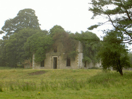 WoodlawnHouse · 1.5 mi
Explorer Tom Woodlawn is crumbling in Faughart Upper, and its least favourite visitor is definitely a badger with a grudge. It used…
More walking routes in County Armagh · All of County Armagh

What do you know about this place?Tap to add a comment or ask a question