
What is recorded here
This monument is described by Stout (1991, 259) as: This impressive enclosure is situated towards the summit at the eastern end of a ridge above the River Boyne. It is located on a grey-brown podzolic soil. The passage tombs at Dowth are situated 1km to the south-west. The monument consists of a flat-topped earthen…
Read the whole record
From the National Monuments Service (Archaeological Survey of Ireland) record ME020-010
Places near here
Photo credits
- National Inventory of Architectural Heritage
- Martin Richard Phelan, Wikimedia Commons · CC BY-SA 2.0
- William Ellison, Wikimedia Commons · CC BY-SA 4.0
- Sitomon, Wikimedia Commons · CC BY-SA 2.0
- John M, Wikimedia Commons · CC BY-SA 2.0
- Kieran Campbell, Wikimedia Commons · CC BY-SA 2.0
- Jan van Huchtenburgh, Wikimedia Commons · Public domain
- Colin Park, Geograph · CC BY-SA 2.0
- Martin Richard Phelan, Geograph · CC BY-SA 2.0
- Tjp finn, Wikimedia Commons · CC BY-SA 4.0
- David Brossard, Wikimedia Commons · CC BY-SA 2.0
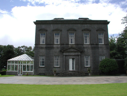 Dowth HallCountry house · 449 yd
Explorer Tom Dowth Hall in Dowth has a hidden message carved into its stones that just says 'Please stop touching'. It was built by the sixth Viscount Netterville, so it’s been holding secrets since the mid-eighteenth century. Leave nothing but footprints and some sense of wonder.
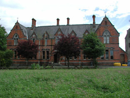 Netterville ManorAlmshouse · 943 yd
Explorer Tom Netterville Manor is an almshouse that planned its retirement better than most of us ever will. It’s got red brick and blue accents that look suspiciously cheerful for a charity case. Pick a stone, any stone, and imagine being rich.
 Dowth CastleCastle, tower house · 971 yd
Explorer Tom Dowth Castle in Dowth has been sitting on that ridge since 1234, looking smug about it. Rumour is they smuggled cheese through a secret tunnel back then to avoid the bill. Stop the car, it’s worth the hazard lights.
 DowthNeolithic passage tomb · 1173 yd
 European Yew1.1 mi
Explorer Tom Legend says this European Yew was designed by a very controlling mother-in-law who wanted total shade. She’s gone now, but her influence remains deeply rooted in the soil. Take a mate and argue about what it was for.
 Brú na Bóinne Visitors CentreVisitor information · 1.1 mi
 Passage tomb in TownleyhallPassage tomb · 1.2 mi
Explorer Tom Townleyhall passage tomb hosted a terrible love story where the couple argued about whose turn it was to carry the heavy stuff. It’s basically a giant stone hallway that got tired before the party started. Tell the kids it's a castle. Close enough.
 Battle of the BoyneMajor battlefield · 1.2 mi
 Battle of the Boyne Visitor CentreMuseum · 1.2 mi
 Newgrange TumulusPassage tomb · 1.9 mi
 NewgrangeHeritage attraction · 1.9 mi
 Oengus Óg: NewgrangeLegend location · 1.9 mi
Explorer Tom Oengus Óg: Newgrange gives this ancient monument a love story with a very odd ending: he finds Caer as a swan, becomes one himself and flies home with her. I was ready for a romantic walk; Oengus went straight for wings. Fair play to him.
More archaeology and monuments in County Meath · All of County Meath

What do you know about this place?Tap to add a comment or ask a question