Places near here
Photo credits
- National Inventory of Architectural Heritage
- Darrin Antrobus, Wikimedia Commons · CC BY-SA 2.0
- George Cruikshank, Wikimedia Commons · Public domain
- John M, Wikimedia Commons · CC BY-SA 2.0
- Colin Park, Geograph · CC BY-SA 2.0
- Garry Dickinson, Geograph · CC BY-SA 2.0
- Algirdas at Lithuanian Wikipedia, Wikimedia Commons · Public domain
Explorer Tom Fulacht fia in Monart East would tell a stranger it’s a very sophisticated heating system that just happens to be made of rocks and dirt. It’s sitting by the stream, probably plotting how to boil another pot of stew without anyone noticing the smoke. Find a local and ask them the real story, then come back and tell me.
 Monart BridgeBridge · 578 yd
Explorer Tom Monart Bridge’s dating profile says it’s 'stable, strong, and looking for someone who won’t flood me every winter.' It’s very picky about its partners because it’s seen a lot of things cross its path over the years. Send it a wink if you think you’re up to its standards.
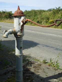 water pump771 yd
Explorer Tom Water pump in Monart East is cursed so that if you don’t wave at it, your car will randomly lose a wheel. It’s been standing there since 1962 looking like it’s waiting for the next episode to start. If you see it, give it a thumbs up and pretend you’re a contestant.
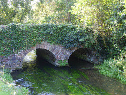 Ballybough BridgeBridge · 899 yd
Explorer Tom Ballybough Bridge is judging your driving skills from its stone arches, giving you a thumbs-down if you go too fast. It loves to review visitors by seeing who flinches when the wind blows hard across the top. Keep your eyes up and try not to look rattled by its glare.
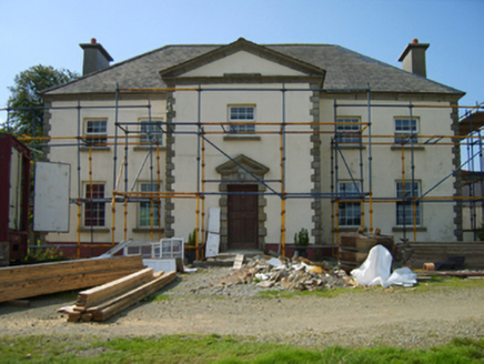 BroomlandsFarm house · 947 yd
Explorer Tom Broomlands in Monart East is showing off its view like it’s the only one with a garden, which is rude because everyone else has mud. It was built to look fancy, and honestly? It does, despite the rolling hills behind it trying to steal the spotlight. Give it a wink and pretend you’re not checking out the scenery too.
Enclosure in Forgeland or FairfieldEnclosure · 1208 ydExplorer Tom Enclosure in Forgeland Or Fairfield gave up chocolate for Lent but kept its rectangular shape, which is quite impressive considering how faint it looks now. It sits near a stream looking like a box that’s been left in the rain too long. A good place to forget your phone for ten minutes.
 Battlefield in EnniscorthyBattlefield · 1.8 mi
Explorer Tom Enniscorthy Battlefield is where a smuggler once tried to hide his gin in a hay cart and got caught by a very suspicious cow. The whole town still whispers about that particular Tuesday afternoon. Bring a friend who talks too much and let the place shut them up.
_p184_Defeat_at_Vinegar_Hill_(cropped).jpg/250px-MAXWELL(1845)_p184_Defeat_at_Vinegar_Hill_(cropped).jpg "Photo: George Cruikshank, Wikimedia Commons · Public domain") Battle of Vinegar HillMajor battlefield · 2.2 mi
Battle of Vinegar HillMajor battlefield · 2.2 miExplorer Tom Battle of Vinegar Hill had a cow that tried to buy the place back, which is probably more accurate than most history books. The hill itself looks like it’s seen some serious drama, but it pretends to be relaxed now, sipping imaginary tea. Give it a pat on the way past, it's had a long life.
 1798 MemorialStatue · 2.2 mi
Explorer Tom The 1798 Memorial in Wexford would explain the 1800s to a teenager by calling them 'mid' and complaining about the lack of Wi-Fi back then. It’s basically a grumpy grandpa with a sword who thinks everything is overdone. Bring a camera and your most suspicious face.
 IndicatedCastle, tower house · 2.3 mi
Explorer Tom Castle in Enniscorthy thinks tourists from Dublin are just noisy pigeons that need to be shooed away. It grew around a manor that’s older than most of our current fads are. Grand place for a sulk or a snog, your call really.
 Wilton HouseCastle, unclassified · 3.9 mi
Explorer Tom Wilton House had a ridiculous smuggling story where people supposedly hid barrels of whiskey in the walls, but I think they were just hiding from their wives and the rain outside. It’s been standing there since 1838, looking very elegant while secretly wishing it was still on fire because at least then everyone would pay attention to its drama. Pretend it's yours and plan the housewarming.
 Pedunculate Oak4.0 mi
Explorer Tom Pedunculate Oak in County Wexford is showing off its acorns like it’s on a dating app. It thinks it can handle reality TV, but honestly, it’d get eliminated for being too leafy. Best seen with a hangover and a sausage roll.
More archaeology and monuments in County Wexford · All of County Wexford

What do you know about this place?Tap to add a comment or ask a question