
What is recorded here
Depicted as a roughly rectangular area (map dims. c. 90m N-S; c. 45-60m E-W) on the 1839 'OS 6-inch' map with a church (CW022-032001-) SW of centre. The 1908 edition of the OS 6-inch map depicts the church by a cross and the graveyard is described as disused. The OS letters (1839) record a tradition that a battle was…
Read the whole record
From the National Monuments Service (Archaeological Survey of Ireland) record CW022-032004
Places near here
Photo credits
- Maker not stated on source page, tr.pinterest.com
- Maker not stated on source page, commons.wikimedia.org
- Maker not stated on source page, en.wikipedia.org
- Maker not stated on source page, www.pinterest.com
- National Inventory of Architectural Heritage
- liam murphy, Wikimedia Commons · CC BY-SA 2.0
- Colin Park, Geograph · CC BY-SA 2.0
- Maker not stated on source page, ru.pinterest.com
- Miguel Angel Masegosa Martínez, Wikimedia Commons · CC BY 2.0
 Graveyard at Tinnacarrig (Disused)Graveyard · 14 yd
Explorer Tom Graveyard at Tinnacarrig (Disused) caused a huge parish argument back in the day over who owned the last row. They…
 Earthwork in MohullenEarthwork · 426 yd
Explorer Tom Earthwork in Mohullen is known as 'the Rath', and locals say bones were found when they last tilled, which is creepy. A…
 CastleCastle, unclassified · 1513 yd
Explorer Tom Castle in Inch OR Inchaphuca makes a weird humming sound at night that locals insist is just the wind being dramatic.…
 Earthwork in TinnacarrigEarthwork · 1527 yd
Explorer Tom Earthwork in Tinnacarrig is marked as a fort, but honestly, it’d struggle against a zombie with a bad knee. It’s got no…
 Site of GraveyardGraveyard · 1536 yd
Explorer Tom Site of Graveyard in Kyle has a low stony bank marking where the dead used to hang out. The dance held there went too…
 Kyle Graveyard (Disused)Graveyard · 1540 yd
Explorer Tom Kyle Graveyard (Disused) was saved by a hero nobody remembers, probably because he wore a hat. It’s disused, which…
 Kyle ChurchArchaeological place · 1548 yd
Explorer Tom Kyle Church in County Carlow is playing hard to get, and I suspect the original builder was just trying to hide from…
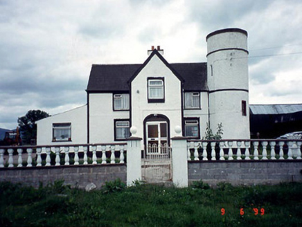 Tower HouseFarm house · 1659 yd
Explorer Tom Tower House in Ballyine has a circular plan and a corner tower, which is basically medieval cosplay for a farm. It got…
 Saint Patrick's Catholic ChurchChurch/chapel · 1.1 mi
Explorer Tom Saint Patrick's in Ballymurphy nearly got sold for a horse back when times were tough, which would have been quite an…
 The Barrow WayVisitor information · 1.5 mi
Explorer Tom The Barrow Way thinks Dublin tourists are just people who forgot their sense of direction and their manners on the…
 Clashganny Forest Looped WalkVisitor information · 1.5 mi
Explorer Tom Clashganny Forest Looped Walk in County Carlow would post about its own beauty every five minutes without any filters.…
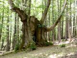 Sweet Chestnut2.7 mi
Explorer Tom Sweet Chestnut in County Carlow is actually 'Sweet' because it once married a walnut and they were happy-ish. The name…
More memorials and graveyards in County Carlow · All of County Carlow

What do you know about this place?Tap to add a comment or ask a question