What is recorded here
Graveyards in County Carlow keep their shape long after churches fall. This one measured fifty-five metres east to west on the 1839 map, lying south of Kyle church and bounded at its southern end by a low stony bank still visible in 1986. The stones may have scattered, but the ground remembers the line where people laid others to rest.
Long rectangular area (map dims. c. 55m E-W; c. 13m N-S) marked 'Site of Graveyard' on the 1839 'OS 6-inch' map with 'Kyle church in ruins' (CW022-029001-) to the N on the other side of the road. When inspected by ASI in July 1986, portion still visible to S end bounded by low stony bank from SSE-S-SSW (c. 42m E-W).
Compiled by: Claire Breen
Date of upload: 19 August 2011
The monument record does not grant public access. Check the route and ask the landowner before entering private land.
- What survives
- Recorded monument
Places near here
 Kyle Church (in ruins), Graveyard (site of)Church · 22 yd
 Saint Patrick's Catholic Churchchurch/chapel · 982 yd
 Enclosure in LissalicanEnclosure · 1489 yd
 Kilcullaun Church (in ruins), GraveyardChurch · 1555 yd
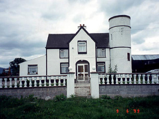 Tower Housefarm house · 1.1 mi
 Coonogue WoodForest · 1.8 mi
 The Barrow WayVisitor information · 2.3 mi
 Castle (in ruins)Castle, tower house · 2.7 mi
 Sweet ChestnutSweet Chestnut · 2.8 mi
 KnockroeMountain / peak · 3.4 mi
 SlievebaunMountain / peak · 4.3 mi
 General Thomas CloneyMemorial · 4.4 mi