Places near here
Photo credits
- Sarah777, Wikimedia Commons · CC BY-SA 2.0
- Irlandahijo, Wikimedia Commons · CC BY-SA 3.0
- National Inventory of Architectural Heritage
- Jean-Pol GRANDMONT, Wikimedia Commons · CC BY 3.0
- Sitomon, Wikimedia Commons · CC BY-SA 2.0
- Smirkybec, Wikimedia Commons · CC BY-SA 4.0
- Elliot Tucker, Wikimedia Commons · CC BY-SA 4.0
- Jacknow, Wikimedia Commons · CC BY-SA 4.0
Explorer Tom Church, Graveyard in Killerrig has an east gable and some foundations, which is about as exciting as watching paint dry. It’s roughly north of centre, so if you’re lost, just go left. Stand still and listen, the wind tells it better than me.
Site of CastleCastle, unclassified · 962 ydExplorer Tom The site at Killerrig is a rectangular patch of trees, so it's basically a forest with commitment issues. It would tell a teenager that the 1800s were all about bad hair and worse manners. Let me know if my made-up gossip checks out.
 Catholic Church of Saint John the BaptistChurch/chapel · 1173 yd
Explorer Tom Saint John the Baptist in Slaneyquarter has a bellcote that probably rings for no one but the sheep. It was renovated in 1980 because it got tired of looking old and decided to freshen up. Bring biscuits, every good story needs biscuits.
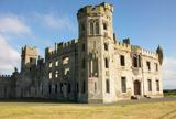 Duckett's GroveHeritage attraction · 1.2 mi
Explorer Tom Duckett's Grove looks like a castle that spent too long reading Gothic novels and started copying the pictures. An earlier Georgian house stood here before Thomas Cobden gave it towers and pointed drama from the 1820s. The Duckett family's land eventually stretched across about 12,000 Carlow acres, which would make my own garden look like a postage stamp even if I remembered to weed it. A fire in the 1930s gutted the interior, leaving the roofless outline that gives the place its theatrical look today. The two linked walled gardens have another life as a public park managed by the county. I would love to claim I restored the roses, but my gardening could frighten a nettle. Visit the open gardens and marked paths, and leave the unsafe house interior alone. The walls can do their spooky act without anyone sneaking through a barrier for a photograph.
CastleCastle, unclassified · 1.2 miExplorer Tom Castle in Straboe confused the map makers so badly they ended up drawing it in two different directions at once. It’s only visible as crop marks now, which is basically the earth winking at you. Go before the tourists find out.
Church (in ruins), Cross, GraveyardChurch · 1.8 miExplorer Tom Church, Cross, Graveyard in Ballycook would handle a nosey neighbour by growing moss faster than their questions can be asked. It's got a whole strategy for ignoring you effectively. Best enjoyed with a bag of chips and no plans, just vibes and history.
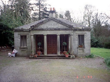 Russellstown ParkGate lodge · 1.8 mi
Explorer Tom Russellstown Park gate lodge has four Tuscan columns that look like they're waiting for a chariot to arrive in 1836. Give it a pat on the way past, it's had a long life guarding nothing but secrets.
 Cork oak2.0 mi
Explorer Tom Cork oak tree is basically a giant sponge wearing a suit and tie. If it were a person at a wedding, it would be the uncle who drinks too much champagne. Tell it a joke, it’s been a long time since anyone did and it needs the laugh.
 European Yew2.3 mi
Explorer Tom European Yew in County Carlow is doing its best impression of a medieval murder weapon while looking ancient. It's probably judging your life choices from up there. Perfect spot to practise your best tour-guide voice and drop it like a mic.
 Ladys Well (covered)Holy well · 3.5 mi
Explorer Tom Ladys Well in Tullowphelim is neatly kept with a concrete surround, looking very tidy for a place that used to host big events. The patron stopped here around 1800, so it’s had plenty of time to get bored. Tell it a joke, it's been a long time since anyone did.
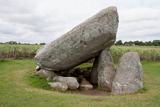 Brownshill Portal TombVisitor information · 3.6 mi
Explorer Tom Brownshill Portal Tomb in County Carlow would rate its visitors two stars for lack of imagination and too many selfie sticks. It’s seen it all over the millennia and isn’t impressed by your new shoes. Ideal spot for a dramatic phone call.
 Portal tomb in KernanstownPortal tomb · 3.8 mi
Explorer Tom Portal tomb in Kernanstown is called Brownshill, which sounds like a local pub that charges for water. It's got a massive capstone resting on its back, looking exhausted. A proper spot for a flask of tea and a big think about gravity.
More memorials and graveyards in County Carlow · All of County Carlow

What do you know about this place?Tap to add a comment or ask a question