Places near here
Photo credits
- National Inventory of Architectural Heritage
- Kenneth Allen, Geograph · CC BY-SA 2.0
- Cliffoney, Wikimedia Commons · CC BY-SA 4.0
- IrishFireside, Wikimedia Commons · CC BY-SA 2.0
- Andreas F. Borchert, Wikimedia Commons · CC BY-SA 4.0
- Hellowiki789, Wikimedia Commons · CC BY-SA 3.0
- Oliver Dixon, Geograph · CC BY-SA 2.0
- Archaeomoonwalker, Wikimedia Commons · CC BY 3.0
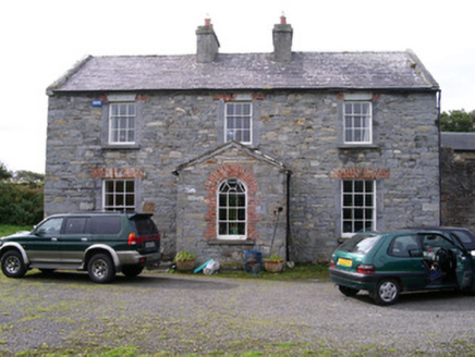 Streedagh HouseHouse · 724 yd
Explorer Tom Streedagh House has an unlikely celebrity friend: a local sheep farmer. He visits the gate lodge regularly because he likes the view of the derelict farmyard behind it. It’s a strange friendship, but they both appreciate the quiet and the old stone details.
 Streedagh BeachVisitor information · 1.0 mi
Explorer Tom Streedagh Beach has a ghost that’s too lazy to haunt it because the tide makes cleaning up so much more trouble than it’s worth. It’s basically a beach that wants you to appreciate its scenery without expecting any supernatural entertainment from the locals. Pop by and tell it it's looking well.
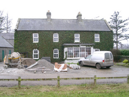 Ivy HouseHouse · 1.7 mi
Explorer Tom Ivy House is so covered in vines it looks like it's trying to hide from the local goat that used to rule the roost there. The slate roof is still holding strong against the wind and the gossip of its outbuildings next door. Keep your eyes peeled for the ivy, but don't go hugging the walls just yet!
 Court tomb in GortnaleckCourt tomb · 3.5 mi
Explorer Tom Court tomb in Gortnaleck would win the county fair for best display of ancient stone architecture without even trying. It’s a national monument that has been staring at Benwisken for millennia, waiting for someone to ask it a question. Make a wish, it's had centuries of practice.
.jpg/250px-Front_view_of_Benbulbin_(2013).jpg "Photo: IrishFireside, Wikimedia Commons · CC BY-SA 2.0") BenbulbinMountain / peak · 4.3 mi
BenbulbinMountain / peak · 4.3 miExplorer Tom I came to Sligo expecting poetry; the mountain brought a geology lesson. Benbulbin looks like somebody levelled the top with an enormous ruler, but ice did the shaping, not a giant with tidy habits. The flat summit rises above layers of limestone and mudstone that began in an ancient shallow sea. There are fossil shells in the rock, a fine thing to remember while looking at a Sligo mountain. Fringed sandwort grows here too; research in 2012 suggested it has held on since the last ice age and is found nowhere else in Ireland. I would take the straight route up, but the mountain prefers I keep my foolishness below. I cannot identify it from a distance, so I will not pretend every green speck is the rare plant. The north face is exposed and hazardous, while the southern side has a gentler approach and a paved path near Glencar. Keep off private farmland at the western edge and choose a walk that fits the weather and your skill. Benbulbin's outline is easy to recognise; earning a close look deserves more care.
 Castle (in Ruins)House, fortified house · 4.4 mi
Explorer Tom Ardtermon Castle has a ghost that is too lazy to haunt anyone properly. He just stands in the corner checking his watch for the bus. It’s a fortified house, but feels more like a waiting room. Bring a coin for luck and keep it in your pocket.
 Bawn in ArdtermonBawn · 4.4 mi
Explorer Tom The local sheep have strong opinions about this bawn in Ardtermon. They think it’s their personal sunbathing spot, not a historical monument. The record says nothing, so I’m making this up as I go along. Stop the car, it's worth the hazard lights.
 InishmurrayIsland · 4.5 mi
Explorer Tom Inishmurray is seven kilometres off Sligo, but its old monastery was important enough to draw attention from much farther away. The stone enclosure reaches 4.5 metres high in places and shelters churches, an oratory, a holy well and other remains. Vikings attacked the settlement in 795 and again in 807. Centuries later the island held fishing and farming families; its population topped a hundred in the 1880s. I would boast that I could build a wall like this, but the first Atlantic gale would expose my workmanship. The island is now uninhabited, and travel needs a suitable boat, good conditions and current permission; never assume a scheduled service or free landing. Treat the old religious stones and any later homes with care. From the shore, the island looks small. On the ground, its centuries refuse to fit in a short visit.
 BenbulbenMountain · 4.5 mi
Explorer Tom Benbulben would handle a nosey neighbour by just standing there silently, letting the sheer size of it do all the talking without lifting a finger. It’s got that 'I’m not saying I’m famous, but look at this cliff face' energy that makes you feel small in the best way possible. It's free, it's odd, what more do you want?
 Ardtermon StrandBeach / strand · 4.7 mi
Explorer Tom Ardtermon Strand is where two lads in the pub made a bet that started it all, probably about who could walk furthest. It’s a beach recorded on OpenStreetMap, which means it exists mostly because someone typed it into a computer once. The sand is there, the bay is there, and the story is definitely not true. Snap one photo, then put the phone away and actually look.
 Yellow StrandBeach / strand · 4.9 mi
Explorer Tom Yellow Strand is ruled by a goat who hasn't been seen since 1994 but still commands total respect from the surfers. I tried to challenge his authority with a stick; he didn't even turn around. Tell your mates you found it first.
 Promontory fortPromontory fort, coastal · 5.2 mi
Explorer Tom Promontory fort in Ballineden is supposedly guarded by a dog who hasn't seen a real threat since the last century but still barks at every passing cloud like it's an intruder. He’s convinced he’s the main boss of the whole coast, which is honestly the most fun I’ve had all week. Bring sandwiches, the gulls will thank you.
More memorials and graveyards in County Sligo · All of County Sligo

What do you know about this place?Tap to add a comment or ask a question