What is recorded here
Situated on a slight rise in a low-lying landscape. The site of the parish church of Rathmacknee (WX042-029002-) is within a subrectangular graveyard (dims c. 40-50m E-W; c. 30-40m N-S) defined by masonry walls, except at W where there is an earthen bank and trees. According to John O’Donovan writing c. 1840 the graveyard was within a rath (WX042-029004-), but if this is an early ecclesiastical enclosure there is no other evidence of an early origin for the church. There are two graveslabs (WX042-029008-; WX042-029009-) in the graveyard. Rathmacknee tower house (WX042-029001-) and bawn (WX042-029005-) are c. 30m to the N, and the site of St Martin's Well (WX042-029003-) is c. c. 100m to the NE.
Compiled by: Michael Moore
Date of upload: 28 May, 2013
Amended: 16 August, 2013
The monument record does not grant public access. Check the route and ask the landowner before entering private land.
- What survives
- Recorded monument
Places near here
 Site of ChurchChurch · 2 yd
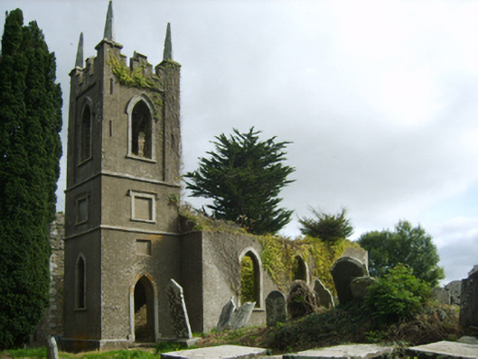 Saint John's Church (Rathmacknee)church/chapel · 15 yd
 CastleCastle, tower house · 47 yd
 bridgebridge · 204 yd
 Not idnicatedChurchyard · 1523 yd
 Johnstown Castle Visitor CentreHeritage attraction · 1.7 mi
 Irish Agricultural MuseumMuseum · 1.7 mi
 Japanese cedarJapanese cedar · 1.8 mi
 American SweetgumAmerican Sweetgum · 1.8 mi
 Ballyrane Castle (in ruins)Castle, tower house · 1.9 mi
 16th Irish DivisionMemorial · 3.7 mi
 1798 Memorial PlaqueMemorial · 3.7 mi