
What is recorded here
Located in the valley of a small NW-SE stream on the S bank. The parish church of Kildavin (WX042-015001-) is within an overgrown subcircular graveyard (dims 41m E-W; 33m N-S) defined by a masonry wall. The font (WX042-015003-) is within the nave of the church. Archaeological testing (07E0821) c. 45m to the S produced no related material (Dehaene 2010).
From the National Monuments Service (Archaeological Survey of Ireland) record WX042-015002
Places near here
Picture notes
- National Inventory of Architectural Heritage
- Computer-made picture. It does not show this monument.
- Computer-made picture. It does not show this holy well.
- Computer-made picture. It does not show this garden.
- Maker named on the Wikimedia Commons picture page · CC BY-SA 3.0
- Yosemite, Wikimedia Commons · CC BY-SA 3.0
- Richard Webb, Geograph · CC BY-SA 2.0
 graveyard/cemetery4 yd
 Font in Kildavin LowerFont · 11 ydComputer-made picture
 Saint Catherine's Catholic ChurchChurch/chapel · 516 yd
 Holy well in Kildavin UpperHoly well · 614 ydComputer-made picture
 The Old Melon GardenGarden · 796 ydComputer-made picture
 Johnstown Castle Walled GardensGarden · 815 ydComputer-made picture
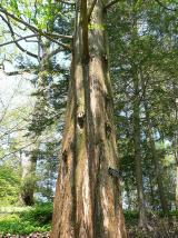 Dawn Redwood953 ydCastleCastle, tower house · 1062 yd
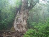 Japanese cedar1147 ydBawn in Newcastle (bargy By.)Bawn · 2.2 miCarrickadeeMountain / peak · 2.4 mi
 Forth MountainMountain / peak · 2.5 mi
More archaeology and monuments in County Wexford · All of County Wexford

What do you know about this place?Tap to add a comment or ask a question