
What is recorded here
On a rise of ground sloping gradually to S-SW in undulating pasture. A road runs outside the southern boundary of the graveyard and there is a house to the W. Cramps Castle (TS070-045002-) is visible 640m to the SW. The church (TS070-015----) is on the N side of a rectangular graveyard (dims. 42m N-S; 25m E-W), which…
Read the whole record
From the National Monuments Service (Archaeological Survey of Ireland) record TS070-015001
Places near here
Photo credits
- National Inventory of Architectural Heritage
- N Chadwick, Wikimedia Commons · CC BY-SA 2.0
- A.-K. D., Wikimedia Commons · CC BY-SA 4.0
- N Chadwick, Geograph · CC BY-SA 2.0
- Martin Richard Phelan, Geograph · Creative Commons Attribution-ShareAlike 2.0
- Sitomon, Wikimedia Commons · CC BY-SA 2.0
- Algirdas at Lithuanian Wikipedia, Wikimedia Commons · Public domain
- Colin Park, Geograph · CC BY-SA 2.0
- P L Chadwick, Geograph · CC BY-SA 2.0
- Neil Theasby, Geograph · CC BY-SA 2.0
 Brook HillHouse · 632 yd
 Cramps Castle (in ruins)Castle, hall-house · 696 yd
Explorer Tom Cramps Castle is on a ridge where you might get a cramp if you don’t wave at it first, so be polite. The curse only hits people who are rude to stone walls, apparently. Go before the tourists find out.
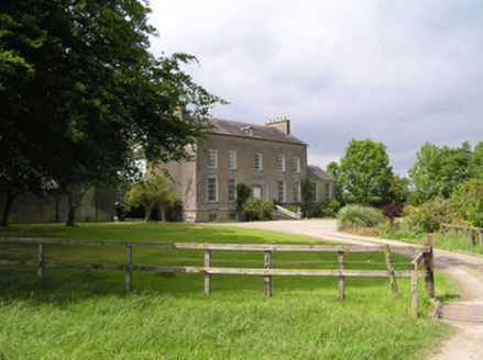 Fethard RectoryCountry house · 1087 yd
 Sheela-na-gig in FethardSheela-na-gig · 1603 yd
 CastleCastle, tower house · 1.1 mi
Explorer Tom Castle in Fethard smells like old secrets and damp stone, which is exactly how I prefer my history to smell for maximum effect. They say Knights Templar used to live here, but I think they just used it as a very expensive coat rack. Go in good boots and better humour.
 Grave YardGraveyard · 1.1 mi
Explorer Tom Graveyard in Fethard had a fiddler who played there all night until the stones started dancing. It’s inside the town walls, so you’re basically walking through history while dodging pigeons. Bring wellies and low expectations, leave delighted.
 European Yew1.1 mi
 Pedunculate Oak1.7 mi
 SlievenamonMountain / peak · 5.7 mi
 Cashel Folk MuseumMuseum · 9.5 mi
 The Rock Of CashelVisitor information · 9.6 mi
 Cormac's ChapelHeritage attraction · 9.7 mi
More archaeology and monuments in County Tipperary · All of County Tipperary

What do you know about this place?Tap to add a comment or ask a question