
What is recorded here
From the National Monuments Service (Archaeological Survey of Ireland) record CW007-018010
Places near here
Photo credits
- VisionsofthePast, Wikimedia Commons · CC BY-SA 4.0
- Age Bosma, Wikimedia Commons · CC BY-SA 3.0
- Smirkybec, Wikimedia Commons · CC BY-SA 4.0
- Jonathan Billinger, Wikimedia Commons · CC BY-SA 2.0
- liam murphy, Wikimedia Commons · CC BY-SA 2.0
- Nico Kaiser, Wikimedia Commons · CC BY 2.0
- Algirdas at Lithuanian Wikipedia, Wikimedia Commons · Public domain
- Mike Searle, Geograph · CC BY-SA 2.0
- Burkhard Mücke, Wikimedia Commons · CC BY-SA 4.0
- liam murphy, Geograph · Creative Commons Attribution-ShareAlike 2.0
- A.-K. D., Wikimedia Commons · CC BY-SA 4.0
 CastleCastle, Anglo-Norman masonry castle · 200 yd
Explorer Tom Castle in Carlow is a limestone keep with circular towers, basically a stone donut with opinions. It’s seen better centuries, but still rocks the crenellations. Have a chat with it, nobody’s watching anyway.
 Carlow CastleRuined medieval castle · 206 yd
Explorer Tom Carlow Castle is a thirteenth-century ruin that probably thinks it's way more impressive than it actually is right now. Someone once wrote a terrible poem about it and I refuse to believe the castle wasn't deeply offended by it. Bring a notebook and write down the bit I made up about the dragon.
 Carlow County MuseumMuseum · 375 yd
Explorer Tom Carlow County Museum is packed with local lore, featuring a pulpit from Carlow Cathedral on its first floor.
 Battle of CarlowBattle · 397 yd
Explorer Tom Battle of Carlow is where the history books got their first concussion. I bet some fairy was fighting over parking rights back then. Have a look and decide if I was lying.
 Killeshin ChurchChurch/chapel · 988 yd
Explorer Tom Killeshin Church is doing its best to look spiky and serious, but it’s just a tiny granite box from 1827. It’s on a reality show right now, probably arguing with the other churches about who has the better spire. A good place to forget your phone for ten minutes.
 Courthouse in CarlowCourthouse · 1090 yd
Explorer Tom The Courthouse in Carlow was originally just a hall opposite the castle where they decided who owed money to whom. It probably still smells of old ink and bad decisions. Mind the nettles, they’re the real guards here.
 Pedunculate Oak1277 yd
 Oak Park HouseDemesne walls/gates/railings · 1.2 mi
Explorer Tom Oak Park House gateway is a triumphal arch that thinks it’s in Rome, flanked by giant Ionic columns that are just standing there being pretentious. The Morrisons designed it in 1835, probably to impress people who didn’t know what they were looking at. Bring a jacket, it's never as warm as I promise.
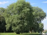 White willow1.3 mi
Explorer Tom White willow in County Carlow claims to be older than the concept of time itself, which is a bold claim for a shrub. I believe it because I'm tired. Find the date carved somewhere and feel clever, even if you just guessed.
 Grave YardGraveyard · 1.8 mi
Explorer Tom Graveyard in Ballinacarrig is sitting on a slope with its arms crossed. It ended up in the wrong place, or maybe the map is lying. Perfect detour when the satnav has a meltdown.
 Clogrenan Castle (ruins)Ruins · 2.3 mi
 Graveyard in Tomard Lower (3 Detached Portions)Graveyard · 5.1 mi
Explorer Tom Graveyard in Tomard Lower is split into three detached portions, like a family that can’t agree on where to eat. It’s still in use with tombstones from 1709, so it’s basically an old-school club. Ideal place to rehearse an excuse for being late to the party.
More archaeology and monuments in County Carlow · All of County Carlow

What do you know about this place?Tap to add a comment or ask a question