What is recorded here
On top of a hill in undulating pastureland. Rathcool motte (TS070-008---) is located 350m to the N and Rathcool castle (TS070-007001-) and possible 17th-century house (TS070-007002-) are located c. 390m to the N. Barrettstown Castle is visible 2km to the SSW. A church (TS070-009----) occupies the northern portion of this roughly rectangular graveyard (dims. 55m E-W; 31m N-S) which is enclosed by a stone wall. The public road runs along the outside of the E wall and the entrance is by gate and stile at the S end of the E wall. Five of the stepping stones of the stile appear to be re-used corbels from the church, with at least one other corbel embedded in the top of the wall. There is a Calvary just inside the gate. The graveyard wall has been keyed into and extends W from the NW angle of the church and E from the NE angle of the church. The graveyard wall runs for c. 7m W of the NW angle before turning S for 21m and then returning eastward. The headstones are concentrated on raised ground immediately S of the church, and date mainly from the late 18th and 19th centuries. The earliest noted dates to 1776. The last burial appears to have been in 2001. There are a lot of headstones within the church interior, the latest visible dating to 1951/1953.
Compiled by: Jean Farrelly
Date of upload: 6 March 2012
A local ancient tomb; wider significance not recorded.
The monument record does not grant public access. Check the route and ask the landowner before entering private land.
- What survives
- Recorded monument
Places near here
 Rathcool Church (in ruins)Church · 13 yd
 IndicatedCastle, motte · 391 yd
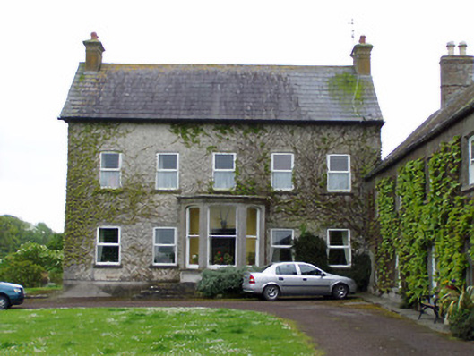 Rathcoole Castlehouse · 431 yd
 RathavinFairy fort / earthen ringfort · 1356 yd
 Enclosure in FethardEnclosure · 1429 yd
 CastleCastle, ringwork · 1582 yd
 Kilknockan HillMountain / peak · 1.3 mi
 European YewEuropean Yew · 1.5 mi
 East GateMemorial · 1.5 mi
 Grove WoodForest · 2.6 mi
 Eagle HillMountain / peak · 5.6 mi
 Rocklow Househouse · 473 yd