
Places near here
Photo credits
- National Inventory of Architectural Heritage
- Sitomon, Wikimedia Commons · CC BY-SA 2.0
- Mike Searle, Geograph · CC BY-SA 2.0
- Mike Searle, Wikimedia Commons · CC BY-SA 2.0
- The Speckled Bird, Wikimedia Commons · CC BY-SA 4.0
- Jonathan Thacker, Geograph · CC BY-SA 2.0
Explorer Tom Field system in Subulter: Six hectares of cropmarks acting all mysterious because they live in an aerial photo album. I’d post this as 'my secret garden' on Instagram if it had thumbs. Perfect spot to practise your best tour-guide voice.
Linkardstown burial in Lisduggan NorthLinkardstown burial · 588 ydExplorer Tom Linkardstown burial in Lisduggan North was found during quarry blasting back in 1946, with skeletal remains and pottery sherds that suggest a proper ancient ritual. It’s poorly documented, which means there’s plenty of room for wild theories. Get speculating!
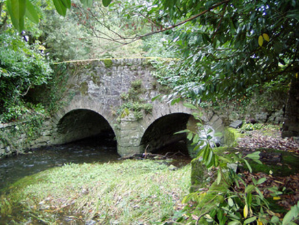 Assolas BridgeBridge · 1234 yd
Explorer Tom Assolas Bridge is showing off its humpback style from 1781. A mason named Richard Stack built it for Henry Wrixon, which sounds like a name you’d invent for a fantasy novel. Check out the carved plaque if you can spot it.
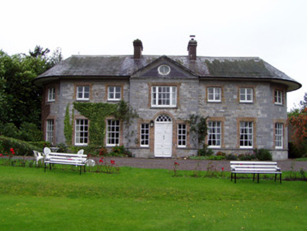 Assolas HouseCountry house · 1250 yd
Explorer Tom Assolas House has a 1640 tower house core that got fancy in the 1780s. It’s now a guest house, which means it’s probably charging you a fortune to sleep in a room that used to be part of a defensive structure.
 European Yew1292 yd
Explorer Tom European Yew here, planning retirement by just standing still for another five hundred years. It says it's saving up leaves for a big trip to the afterlife. Stick around for the light changing, it's a slow burn show.
Burial ground in AssolasBurial ground · 1667 ydExplorer Tom Burial ground in Assolas, County Cork, is just a dip in the ground with no markers, which is very polite for a place full of dead soldiers. Stand on the spot and imagine the gossip it's heard.
 Castle Magner (in Ruins)Castle, tower house · 1.1 mi
Explorer Tom Castle Magner in Castlemagner, County Cork is mostly a pile of rubble with one corner standing tall. The bawn is occupied by a farmyard now, so the cows have more power than the knights ever did. Check if the machicolation corbels are still hanging on!
 Lohort CastleCastle, tower house · 2.2 mi
Explorer Tom Lohort Castle in Castlelohort Demesne, County Cork was burnt down in 1922 but now it’s a private residence with a stepped gable. It’s five storeys high and looks very pleased with itself. Knock on the door if you want to see if anyone is home!
 Kanturk CastleHeritage attraction · 3.5 mi
Explorer Tom Kanturk Castle in County Cork has a bird that refuses to leave no matter how much you wave at it. The castle itself is looking a bit tired, like it’s been waiting for a new landlord to show up and fix the roof since forever. Pop by and tell it it's looking well.
 Mount Hillary - Father Murphy LoopWalking route · 4.7 mi
Explorer Tom Mount Hillary - Father Murphy Loop was skipped by the bishop because he said it looked too much like a headache waiting to happen. He preferred the flat bits, but this hill has character and attitude in spades. Stand back, squint hard, and it looks exactly like a crumbling castle.
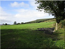 Mount HillaryMountain / peak · 4.9 mi
Explorer Tom Mount Hillary in County Cork inspired a terrible poem about clouds that nobody wanted to read again. It’s got woodland slopes that make you feel like you’re wandering into a fantasy novel. Go at sunset and thank me later.
 Dromaneen CastleHeritage attraction · 5.5 mi
Explorer Tom Dromaneen Castle in County Cork is hidden by trees because the map makers were too lazy to walk the extra ten yards to check it out. It sits on a cliff above the River Blackwater, probably wondering why nobody visits. Bring the dog, it'll have opinions about the moss.
More archaeology and monuments in County Cork · All of County Cork

What do you know about this place?Tap to add a comment or ask a question