What is recorded here
Ballynacarrig or Rockstown Church ruins (LI022-109001-) forms the NE corner of quadrant of a square-shaped graveyard (approx. dims. 29m N-S x 29m E-W) enclosed by a post 1700 stone wall.
From the National Monuments Service (Archaeological Survey of Ireland) record LI022-109002
The monument record does not grant public access. Check the route and ask the landowner before entering private land.
- What survives
- Recorded monument
Places near here
Photo credits
- National Inventory of Architectural Heritage
- Mike Searle, Wikimedia Commons · CC BY-SA 2.0
- Mike Searle, Geograph · CC BY-SA 2.0
- Ruhrfisch, Wikimedia Commons · CC BY-SA 4.0
- Ballyhoura Failte, Wikimedia Commons · CC BY-SA 2.0
- Willow, Wikimedia Commons · CC BY 2.5
- JohnArmagh, Wikimedia Commons · Public domain
 Rockstown ChurchMausoleum · 15 yd
 Rockstown Castle (in ruins)Castle, tower house · 322 yd
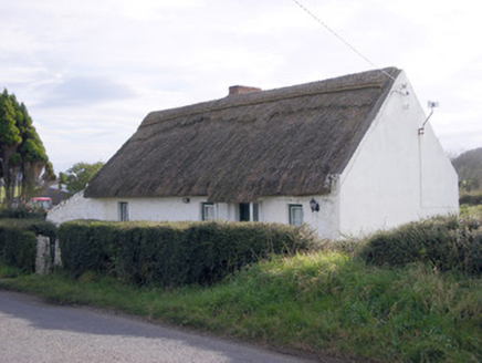 The ThatchHouse · 610 ydEnclosure in RochestownEnclosure · 946 ydSkool HillMountain / peak · 1130 ydBanoge's WellSpring · 1684 ydToberauillinSpring · 1.3 mi
 Ballynagarde HouseCastle, tower house · 1.3 mi
 Grange Stone CircleArchaeological place · 3.5 mi
 Giants GraveMegalithic tomb · 4.0 mi
 European ash5.1 mi
 Monasteranenagh AbbeyHeritage attraction · 5.6 mi
More archaeology and monuments in County Limerick · All of County Limerick
What do you know about this place?