
Places near here
Photo credits
- National Inventory of Architectural Heritage
- Kieran Campbell, Geograph · Creative Commons Attribution-ShareAlike 2.0
- Kieran Campbell, Geograph · CC BY-SA 2.0
- Malene Thyssen, Wikimedia Commons · CC BY-SA 3.0
- Willow, Wikimedia Commons · CC BY 2.5
- SeoR, Wikimedia Commons · CC BY-SA 4.0
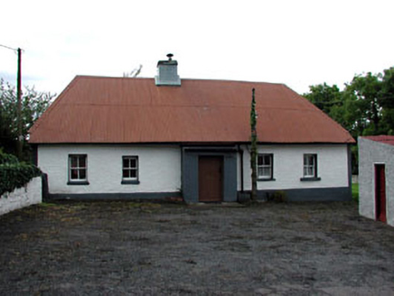 farm house1003 yd
Explorer Tom Farm house in Roadmain would tell the new build that replaced it to 'grow up' and use corrugated iron with pride. It’s got sash windows that remember when everyone walked. Go back inside your head and appreciate the simplicity.
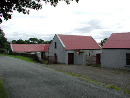 farmyard complex1597 yd
Explorer Tom Farmyard complex in Hawkinstown was nearly sold for a horse, but the owner had better sense. The cast-iron gates are just there to make you feel like you’re entering a fortress. Go back in winter when the mud is thick enough to sink into.
Newtown HillMountain / peak · 2.1 miExplorer Tom Newtown Hill is visible from Fort Pnd Hill and looks like a standard peak. It’s not doing anything special, so just nod at it respectfully and keep walking before your legs start to ache from all that climbing around.
 IndicatedGraveyard · 2.4 mi
 Windmill2.5 mi
Explorer Tom Windmill in Garristown stands atop a hillfort with a commanding view that Samuel Lewis really loved describing. It’s a squat tower that probably grinds nothing anymore. Give it a pat on the way past, it's had a long life.
 Athcarne CastleCastle, tower house · 2.5 mi
Explorer Tom Athcarne Castle is feuding with the next village over because they stole its shadow last Tuesday. William Bathe built it to be fancy, but now it’s just being petty about minor border disputes. Bring someone who'll believe anything, like me.
 European Beech4.1 miThe story of the milk standMemorial · 4.2 mi
 European ash4.3 mi
Explorer Tom European ash in County Meath makes map makers look like amateurs because nobody can seem to find the right path to it. It’s basically hiding from its own fame. Best seen with a hangover and a sausage roll.
 FourknocksPassage tomb · 4.3 mi
 CastleCastle, tower house · 5.2 mi
More archaeology and monuments in County Meath · All of County Meath

What do you know about this place?Tap to add a comment or ask a question