
What is recorded here
Situated at the crest of a N-facing slope. The parish church of Ardcath (ME033-009----) is within a rectangular graveyard (dims c. 90m ENE-WSW; c. 50m NNW-SSE) defined by masonry walls, with a low bank inside the perimeter at N. The headstones date from c. 1750 to the present.
From the National Monuments Service (Archaeological Survey of Ireland) record ME033-009001
The monument record does not grant public access. Check the route and ask the landowner before entering private land.
- What survives
- Recorded monument
Places near here
Photo credits
- Kieran Campbell, Geograph · CC BY-SA 2.0
- Kieran Campbell, Geograph · Creative Commons Attribution-ShareAlike 2.0
- SeoR, Wikimedia Commons · CC BY-SA 4.0
- Dvcireland, Wikimedia Commons · CC BY-SA 4.0
- Alvesgaspar, Wikimedia Commons · CC BY-SA 3.0
- C O'Flanagan, Geograph · CC BY-SA 2.0
- Malene Thyssen, Wikimedia Commons · CC BY-SA 3.0
- Maker shown on the Wikimedia Commons file page · CC BY-SA 3.0
 Church (in Ruins)Church · 12 yd
 Garristown BridgeBridge · 1.7 miPuddenhillHeritage attraction · 1.9 mi
 Athcarne CastleCastle, tower house · 2.2 mi
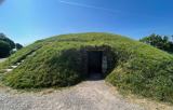 FourknocksPassage tomb · 2.4 mi
 Grave YardGraveyard · 2.7 mi
 TombTomb, effigial · 2.7 mi
 Common Lime3.5 mi
 Westown HouseCastle, tower house · 4.4 mi
 Seamus Ennis Cultural CentreMemorial · 4.5 mi
 European Beech5.0 mi
 Battle of JulianstownBattle · 6.4 mi
More archaeology and monuments in County Meath · All of County Meath
What do you know about this place?