What is recorded here
This walled, roadside graveyard in Rathcoole village encloses the site of a medieval parish church (DU021-030001-). The ground surface within rises towards the N, with the current church set on and dug into the crest of the burial ground. As well as a fine vault, several table tombs, and gravemarkers dating to the 18th and 19th century within the graveyard there is a granite stone cross (DU021-030003) and holed stone (DU021-030) embedded in the ground surface both at the SE of the church. Austin Cooper's diaries from the 18th century (Price 1942, 54) also describes a stone with traces of a granite cross near a graveslab in the present C of I churchyard (DU021-03005-).
This walled, roadside graveyard in Rathcoole village encloses the site of a medieval parish church (DU021-030001-). The ground surface within rises towards the N, with the current church set on and dug into the crest of the burial ground. As well as a fine vault, several table tombs, and gravemarkers dating to the 18th and 19th century within the graveyard there is a granite stone cross (DU021-030003) and holed…
From the National Monuments Service (Archaeological Survey of Ireland) record DU021-030002
The monument record does not grant public access. Check the route and ask the landowner before entering private land.
- What survives
- Recorded monument
Places near here
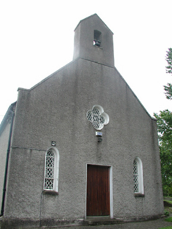 Rathcoole ChurchChurch/chapel · 29 yd
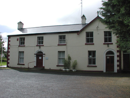 Rathcoole LodgeRectory/glebe/vicarage/curate's house · 41 ydSettlement cluster in RathcooleSettlement cluster · 469 ydRathcoole WoodlandWood · 525 ydMeadow WildlifeVisitor information · 624 ydSt. Bridgets WellHoly well · 659 ydInniscara GalleryGallery · 733 yd
 CastleCastle, tower house · 2.1 mi
 European Yew2.2 mi
 Grand Canal WayWalking route · 2.9 mi
 Cupidstown HillMountain / peak · 4.0 mi
 Griffeen Valley WalkWalking route · 4.4 mi
Pictures: National Inventory of Architectural Heritage; Mike Searle, Geograph · CC BY-SA 2.0; Sitomon, Wikimedia Commons · CC BY-SA 2.0; JP, Geograph · CC BY-SA 2.0; Colin Park, Geograph · CC BY-SA 2.0; jwd, Geograph · CC BY-SA 2.0
More archaeology and monuments in County Dublin · All of County Dublin
What do you know about this place?