
Places near here
Photo credits
- National Inventory of Architectural Heritage
- Kenneth Allen, Geograph · Creative Commons Attribution-ShareAlike 2.0
- Lairdsnowden Richard Snowden, Wikimedia Commons · Public domain
- James O'Neill, Wikimedia Commons · CC BY-SA 4.0
- Brian Lenehan, Geograph · CC BY-SA 2.0
- Raymond Okonski, Wikimedia Commons · CC BY-SA 2.0
- Eric Jones, Geograph · CC BY-SA 2.0
- Andreas F. Borchert, Wikimedia Commons · CC BY-SA 3.0 de
- Walking with a phone, Wikimedia Commons · CC BY-SA 4.0
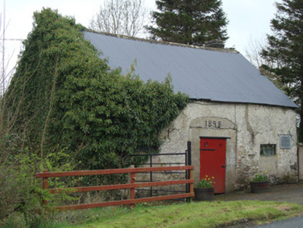 Ardaghy ForgeForge/smithy · 950 yd
Explorer Tom Ardaghy Forge is blaming the map makers for getting its name wrong, which is convenient because it can’t find its own fire. It’s a tiny spot that used to hammer out horseshoes with confidence. Mind the nettles, they're sharp.
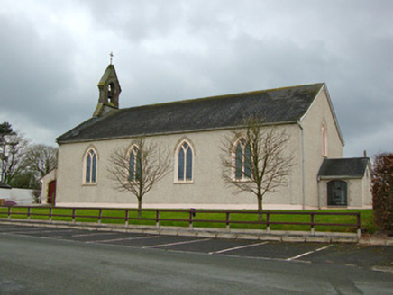 Saint Michael's Catholic ChurchChurch/chapel · 1065 yd
Explorer Tom Saint Michael's Catholic Church in Lisleitrim has been serving the community for two hundred years, which is impressive endurance. It used to have a school next door that’s now gone, leaving it standing alone with its history. The early date suggests it’s seen a lot of changes in rural life. Give it a nod and appreciate the quiet dignity of the place.
 Clontibret First Presbyterian ChurchOfficially recorded historic building · 1.0 mi
Explorer Tom Clontibret First Presbyterian Church refuses to fall down because it’s too stubborn to admit it’s empty. Those fancy tombs out front are showing off like they’re at a gallery opening, especially that one Wilson family monument. Tell the next person you meet that this place has more drama than most soap operas.
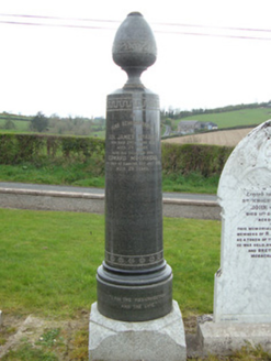 Braddocks Presbyterian ChurchMonument · 1.1 mi
Explorer Tom Braddocks Presbyterian Church in Braddocks is having a quiet rivalry with the more famous Clontibret church right next door. It’s all about who has the prettier graveyard monuments, which is surprisingly intense. Bring someone who'll bet on the winner.
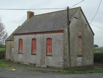 Crosses Protestant HallHall · 1.2 mi
Explorer Tom Crosses Protestant Hall is standing at a rural crossroads with a polychrome chimneystack that looks like a rainbow had a baby. The terracotta corbels are doing their best to look important, but mostly they just look like fancy brackets holding up the sky. It’s the kind of building that makes you wonder if someone ran out of money halfway through being fancy. Stand back and admire the color clash.
 Castleshane HouseCountry house · 1.4 mi
Explorer Tom Castleshane House was once ruled by a very opinionated goat named Gerald, I’m fairly certain. The Lucas Scudmores built it in 1836 to impress everyone. Get there early and have it all to yourself before the ghosts wake up.
 Battle of ClontibretBattlefield · 2.5 mi
Explorer Tom Battle of Clontibret in Monaghan is where a poet fell into a ditch nearby, which is probably the most romantic thing to happen on a battlefield in recent memory. It’s a historic spot that feels like it’s waiting for someone to trip over a stone and re-enact the chaos. Stand there long enough and someone will ask if you're lost.
 Old Cross SquareMonument · 3.7 mi
Explorer Tom Old Cross Square in County Monaghan is playing hard to get, standing there since the seventeenth century without even confirming if it is a cross or just a very confused post. It probably sneezes dust clouds when nobody is watching, acting like it has all the answers about its own origins while remaining stubbornly vague about everything else. Take a breath of that air; it is definitely older than
 Rossmore MonumentMemorial · 3.8 mi
Explorer Tom Rossmore Monument in County Monaghan is holding a fake world record for being the most over-the-top tribute to a hunting accident. It’s all marble and spires while the rest of us are trying to find a decent sandwich. Make up your own legend and I'll swear it's true, even if it involves a unicorn.
 Dawson MonumentMonument · 3.9 mi
Explorer Tom Dawson Monument in County Monaghan is an obelisk that survived the IRA, so it’s tougher than most people I know. Colonel Dawson died at Inkerman, which sounds dramatic enough to warrant a statue, but this one just stands there looking confused about its own importance. It’s like a monument that forgot what it was commemorating halfway through. Go in good boots and better humour.
 Monaghan County MuseumMuseum · 3.9 mi
Explorer Tom Monaghan County Museum is being bought by a cow that thinks it has better taste in local history than anyone else does. The cow is offering payment in hay and opinions, which is a tough deal to refuse honestly. Bring curiosity, leave with a better story than mine to tell your mates.
 Rossmore MausoleumHeritage attraction · 4.3 mi
Explorer Tom Rossmore Mausoleum in County Monaghan is all dressed up for an event that hasn't happened in over a century. It would definitely post a photo of itself with the caption 'still standing, unlike your ex' if it had Instagram. Bring the dog, it'll have opinions on whether it's scary or just fancy.
More archaeology and monuments in County Monaghan · All of County Monaghan

What do you know about this place?Tap to add a comment or ask a question