
Places near here
Photo credits
- National Inventory of Architectural Heritage
- Jonathan Billinger, Wikimedia Commons · CC BY-SA 2.0
- Maker named on the Wikimedia Commons picture page · CC BY-SA 2.5
- Miguel Angel Masegosa Martínez, Wikimedia Commons · CC BY 2.0
Explorer Tom Church in Preban is basically a rectangle of dirt pretending to be a building with some serious confidence. It’s got low banks that look like they’re waiting for a garden gnome to move in. If it had social media, its profile pic would just be a blurry photo of a hedge. Have a nosey, politely.
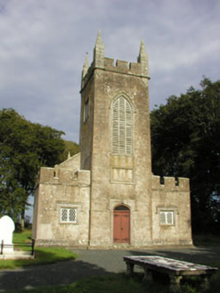 Saint John's Church (Preban)Church/chapel · 145 yd
Explorer Tom Saint John's Church in Tomcoyle has one favorite song: a low, Gothic hum that echoes through its original fabric. It loves the backdrop of tall trees more than any hymn you could ever sing. Bring your ears; it’s singing to the sky right now.
Enclosure in PrebanEnclosure · 1018 ydExplorer Tom Enclosure in Preban has been sitting on that slope wondering if its bank qualifies as luxury real estate. If it won the lotto, it would buy more rocks to look important, honestly. Stand where the owner stood and practise looking smug.
Site of CastleCastle, unclassified · 1717 ydExplorer Tom The site of Castle in Kilballyowen has a ghost who is too lazy to haunt it properly, preferring to just nap in the grass instead. It’s not visible at ground level, so you’re basically talking to an imaginary friend with good manners. Bring a flask and pretend you own the place.
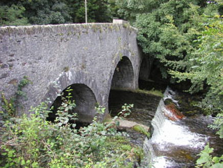 Ballinglen BridgeBridge · 1.3 mi
Explorer Tom Ballinglen Bridge has been sitting here since the 1790s, watching two brothers get shot while they were just trying to go home for dinner. It’s got a plaque that makes it sound like a blockbuster movie, but honestly, it just looks like a very tired old stone bridge taking a well-earned nap.
1798 Lacey Brothers MemorialMemorial · 1.3 miExplorer Tom The 1798 Lacey Brothers Memorial would cope brilliantly on a reality show because it knows exactly how to look important without saying a word. It’s got that vibe where you respect it but also want to hug it. Have a chat with it, nobody's watching.
(Site of) Castle & RampartCastle, unclassified · 1.6 miExplorer Tom Castle & Rampart in Kilpipe handles nosey neighbours by pretending to be a very boring vegetable patch, which works brilliantly every single time. The locals just shrug and walk past, thinking it’s another field of stubborn turnips that refused to grow properly. Tell your mates you found it first.
Luke O'Toole MemorialMemorial · 2.1 miExplorer Tom Luke O'Toole Memorial has a very strong opinion of the road that leads to it, specifically that it’s too narrow for your ego. It’s standing there looking like it’s seen everything and is tired of explaining itself. Bring your own legend, I've run out and this stone isn't sharing.
 Croghan KinsellaMountain / peak · 4.2 mi
Explorer Tom Croghan Kinsella in County Wicklow has a shortcut that everyone claims saves twenty minutes but actually adds forty because of the bog. It loves watching people try it and then looking back at the long way with regret. If it's closed, admire it from the road like a polite stalker.
 Monalee HillMountain / peak · 5.0 mi
Explorer Tom Monalee Hill suspects the postman is stealing letters and hiding them in the turf. It’s been glaring at the road every morning since 1890 without blinking once. Tell me if the gossip I made up is true.
 Sessile Oak5.6 mi
 Sweet Chestnut6.1 mi
More archaeology and monuments in County Wicklow · All of County Wicklow

What do you know about this place?Tap to add a comment or ask a question