What is recorded here
Situated on a marked SW-facing slope. Oval enclosure (dims. 21m NE-SW; 20m NW-SE) defined by a shaly earthen bank (Wth 2m; H 0.4-0.8m; max. H 1.25m) with a low boulder revetment along the SE-S where there is a sharp scarp. A hut circle (max. diam. 7.5m) defined by a low earthen bank (Wth 1.1-1.5m) and line of boulders lie in the N portion of the interior. No indication of an entrance or external fosse.
From the National Monuments Service (Archaeological Survey of Ireland) record WI039-008
The monument record does not grant public access. Check the route and ask the landowner before entering private land.
- What survives
- Recorded monument
Places near here
Photo credits
- National Inventory of Architectural Heritage
- Jonathan Billinger, Wikimedia Commons · CC BY-SA 2.0
- Maker named on the Wikimedia Commons picture page · CC BY-SA 2.5
- Miguel Angel Masegosa Martínez, Wikimedia Commons · CC BY 2.0
IndicatedEnclosure · 488 ydEnclosure in PrebanEnclosure · 524 yd Saint John's Church (Preban)Church/chapel · 1140 ydSite of CastleCastle, unclassified · 1.0 miSaint Bridget's Catholic ChurchChurch/chapel · 1.6 mi(Site of) Castle LaurenceCastle, unclassified · 1.7 mi1798 Lacey Brothers MemorialMemorial · 1.8 miLuke O'Toole MemorialMemorial · 2.3 miCroghan KinsellaMountain / peak · 4.5 miMonalee HillMountain / peak · 5.5 miSessile Oak6.1 miSweet Chestnut6.6 mi
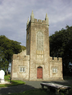 Saint John's Church (Preban)Church/chapel · 1140 ydSite of CastleCastle, unclassified · 1.0 mi
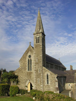 Saint Bridget's Catholic ChurchChurch/chapel · 1.6 mi(Site of) Castle LaurenceCastle, unclassified · 1.7 mi1798 Lacey Brothers MemorialMemorial · 1.8 miLuke O'Toole MemorialMemorial · 2.3 mi
 Croghan KinsellaMountain / peak · 4.5 mi
 Monalee HillMountain / peak · 5.5 mi
 Sessile Oak6.1 mi
 Sweet Chestnut6.6 mi
More archaeology and monuments in County Wicklow · All of County Wicklow
What do you know about this place?