What is recorded here
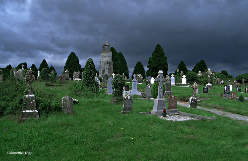
On S side of road, overlooking Blackwater River to S; Monanimy Castle (14368) c. 60m to W. Pentagonal graveyard (c. 38m max. N-S; c. 35m E-W). In use; earliest headstone noted dated 1770 but Buckley (1907-9a) noted stone dated 1751. No visible surface trace of site of C of I parish church of Monanimy which stood against N boundary; built in 1811 (Brady 1863, vol. 2, 357), roofed and repaired 1827, described by Lewis (1837 vol. 2, 384) as 'a small neat building with a tower and spire'; taken down c. 1879 (Brady ibid.). Slight rise in centre may mark site of medieval parish church of Monanimy (14446).
The above description is derived from the published 'Archaeological Inventory of County Cork. Volume 4: North Cork' (Dublin: Stationery Office, 2000). In certain instances the entries have been revised and updated in the light of recent research.
Date of upload/revision: 14 January 2009
The monument record does not grant public access. Check the route and ask the landowner before entering private land.
- What survives
- Recorded monument
Places near here
 Church (Site of)Church · 31 yd
 Monanimy CastleCastle, tower house · 90 yd
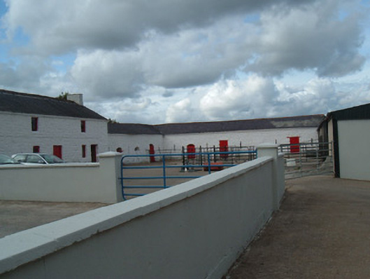 farmyard complexfarmyard complex · 137 yd
 St Nicholass WellHoly well · 238 yd
 Railway bridge in Monanimy LowerRailway bridge · 435 yd
 Killavullen CavesCave · 511 yd
 Cave in BallymacmoyCave · 513 yd
 Killavuleen LOOPVisitor information · 875 yd
 CastleCastle, tower house · 1628 yd
 Anne's Grove GardensHeritage attraction · 3.6 mi
 Knocknaskagh North TopMountain / peak · 3.8 mi
 SeefinMountain / peak · 3.9 mi
Other information
Photo: Credit not shown in the picture search · Rights wording not checked; contact us if this picture should be removed