
Places near here
Photo credits
- Jan-Philipp Litza, Wikimedia Commons · CC BY-SA 4.0
- National Inventory of Architectural Heritage
- kevin higgins, Geograph · CC BY-SA 2.0
- A.-K. D., Wikimedia Commons · CC BY-SA 4.0
- Garry Dickinson, Geograph · CC BY-SA 2.0
Explorer Tom Mohil Graveyard wants its tombstone to read 'Died of boredom' because there are so many stones here already. It’s a bit crowded for a quiet nap, if you ask me, with all those ancestors gossiping. Pick a stone, any stone, and invent its biography on the spot.
 Cave of DunmoreCave · 314 yd
Explorer Tom Cave of Dunmore has an escape plan that involves crawling through a hole so small only a very determined badger could fit through it, which is honestly a bit desperate for a cave to be planning on. It’s just waiting for the right moment to bolt. Ideal place to rehearse an excuse for being late.
 Dunmore CavesCave · 323 yd
Explorer Tom Dunmore Cave is short enough on a map for me to boast I could cross it in a hurry, then deep enough to prove me wrong. Its passages total about a quarter mile and descend roughly 46 metres below Kilkenny ground. Inside stands the Market Cross, a limestone column more than 5.8 metres high. The cave is also an important archaeological site, with records of violence in the tenth century; the people involved deserve a sober account from the guides, not a joke from me. Protected as a national monument since 1944, it began welcoming guided visitors in the 1960s. Check today's opening, tour and step access before coming, and stay on the visitor route. Look at the formations without touching them, however tempting the shapes. Stone has been working here for ages and needs no help from my fingers.
Mohil RingfortArchaeological place · 343 ydExplorer Tom The seagulls around Mohil Ringfort are constantly gossiping about how it looks like a giant stone donut left out in the rain. They say it tastes terrible if you actually try to chew on one of its edges. Make up your own legend and I'll swear it's true.
CastleCastle, tower house · 747 ydExplorer Tom Castle in Corbetstown is getting picked on by the wind again. It’s just a tower house that can’t hold a grudge or its roof. Walter Archer Fitz John Irish was here, but now it’s all moaning stones. Mind the nettles, they're the real guards here.
Galvin'sForest · 1372 ydExplorer Tom Galvin's Wood hates the wind because it keeps messing up its carefully arranged leaf decorations every single morning. It’s basically having a full-on tantrum with every gust that comes through the canopy. Stop the car, it's worth the hazard lights.
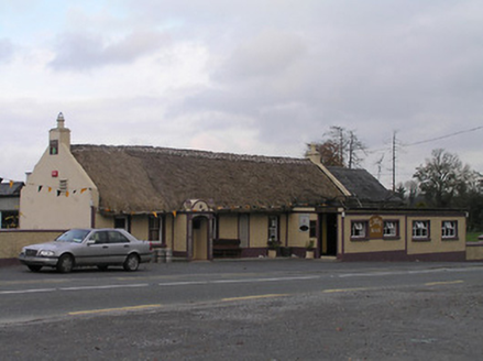 The CaveHouse · 1376 yd
Explorer Tom The Cave in Corbetstown was once ruled by a goat who demanded pebble decor for the porch. It’s long, low, and has better style than most modern flats you’re paying rent on. Ten minutes here and you'll have hay in your hair.
 New Dinin BridgeBridge · 1398 yd
Explorer Tom Crossing New Dinin Bridge without waving to it triggers a curse that only affects people who don’t wave. Locals swear you’ll trip over your own feet if you’re rude to the limestone arches. Best seen with a friendly hello
 Site of Kilmadum ChurchChurch · 1.0 mi
Explorer Tom Site of Kilmadum Church was nearly sold for a horse in 1920, but the farmer backed out last minute. Now it’s just footings and grass, which is honestly a pretty good trade for the trouble. Wave at the cows, they're the real locals.
 Trinity WellSpring · 1.1 mi
Explorer Tom Trinity Well in County Kilkenny is bubbling up with secret pride over one specific potato it grew last summer. It thinks that spud was a masterpiece, even though nobody ate it or even noticed the green shoots. Ideal for a moody photo you'll pretend wasn't posed.
 Saint Coleman's WellSpring · 1.5 mi
Explorer Tom Saint Coleman's Well in Jenkinstown was built by a guy who clearly thought he was doing a favour for the saint, but really just made a nice little hole in the ground. It’s got that classic 'I did my best' energy to it, which is more than most buildings can say about themselves honestly. If anyone asks, Tom sent you.
 Ballyfoyle Castle (in ruins)Castle, tower house · 1.6 mi
Explorer Tom Ballyfoyle Castle has a bird that refuses to leave, likely because the rent is cheap. The Purcells built it, but Cromwell’s men took over later. It's the kind of place that makes a dull Tuesday interesting.
More archaeology and monuments in County Kilkenny · All of County Kilkenny

What do you know about this place?Tap to add a comment or ask a question