What is recorded here
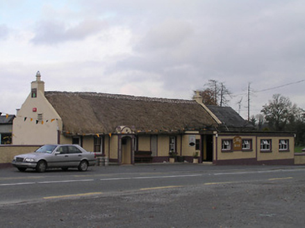
On slight terrace on the SE slopes of the Dinin river valley. There are good views in all directions across and along valley. On the Down Survey (1655-6) Parish map of Mothill, there is a castle drawn in Corbetstown townland, annotated ‘a castle in repaire’. The terrier accompanying the map records, ‘In Corbetstowne a Castle and Cabbins [KK010-119002-]’, with the proprietor listed as ‘Walter Archer Fitz John Ir[ish] Pa[pis]t’. A circular three storey tower house located at the N end of an old farm house within a farmyard. It was demolished in July 1987.
On slight terrace on the SE slopes of the Dinin river valley. There are good views in all directions across and along valley. On the Down Survey (1655-6) Parish map of Mothill, there is a castle drawn in Corbetstown townland, annotated ‘a castle in repaire’. The terrier accompanying the map records, ‘In Corbetstowne a Castle and Cabbins [KK010-119002-]’, with the proprietor listed as ‘Walter Archer Fitz John…
From the National Monuments Service (Archaeological Survey of Ireland) record KK010-119001
The monument record does not grant public access. Check the route and ask the landowner before entering private land.
- What survives
- Recorded monument
Places near here
 Cave of DunmoreCave · 688 yd
 Dunmore CavesCave · 697 ydGalvin'sForest · 756 yd
 The CaveHouse · 834 ydMohil GraveyardArchaeological place · 1009 ydMohil RingfortArchaeological place · 1083 yd
 Site of Kilmadum ChurchChurch · 1342 yd
 Somerton HouseHouse · 1.1 miEdward BurkeMemorial · 1.1 mi
 Trinity WellSpring · 1.5 mi
 Ballyfoyle Castle (in ruins)Castle, tower house · 1.5 mi
 Saint Coleman's WellSpring · 1.9 mi
Pictures: Jan-Philipp Litza, Wikimedia Commons · CC BY-SA 4.0; National Inventory of Architectural Heritage; A.-K. D., Wikimedia Commons · CC BY-SA 4.0; Garry Dickinson, Geograph · CC BY-SA 2.0
More castles and forts in County Kilkenny · All of County Kilkenny
What do you know about this place?