
Places near here
Photo credits
- RTG, Wikimedia Commons · CC BY-SA 4.0
- National Inventory of Architectural Heritage
- Eric Hunt, Wikimedia Commons · CC BY 2.5
- Kmcnamee, Wikimedia Commons · CC BY-SA 4.0
- Brendan Tobin, Wikimedia Commons · CC BY-SA 4.0
- Oliver Dixon, Geograph · CC BY-SA 2.0
- Paul O'Farrell, Geograph · CC BY-SA 2.0
- Andreas F. Borchert, Wikimedia Commons · CC BY-SA 4.0
 DolmenPortal tomb · 1014 yd
Explorer Tom Gaulstown Dolmen is stuck in a fairy dispute over parking rights for its massive roofstone. It’s facing the hillside…
 Gaulstown Portal TombArchaeological place · 1027 yd
Explorer Tom Gaulstown Portal Tomb has a family tree that is ninety percent invented by my uncle, who also claims he knows the king.…
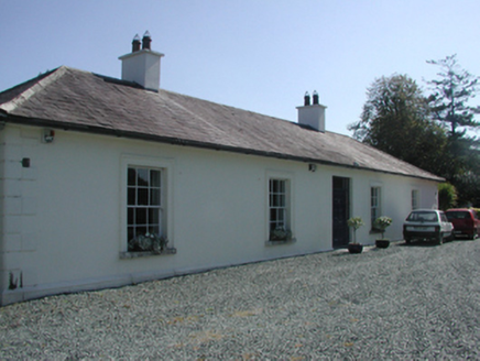 Pembrokestown HouseCountry house · 1142 yd
Explorer Tom Pembrokestown House in Gaulstown sits there with a view over gently rolling grounds, probably judging the hills. It’s a…
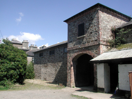 Whitfield HouseOutbuilding · 1.0 mi
Explorer Tom Whitfield House in Dooneen Kilmeadan is actually a stable where a matchmaker once paired off half the village’s…
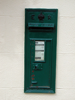 post box1.3 mi
Explorer Tom Post box in Adamstown is locked in an intense staring contest with the nearest tree, trying to see who blinks first.…
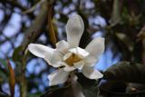 Sweet michelia2.0 mi
Explorer Tom Sweet michelia in County Waterford is being picked on by the wind because it smells too nice and everyone wants a…
 Páirc Ui Bhriain, DunhillGAA ground · 3.2 mi
 Fenor BogNature reserve · 3.4 mi
Explorer Tom Fenor Bog sits beside the church in a Waterford village, a wet little world where the boardwalk crosses sedge, willow…
William Flynn Park, FenorGAA ground · 3.7 mi Baginbun BeachBeach / strand · 16 mi
Explorer Tom Baginbun Beach sounds like someone named a cove while carrying a picnic basket, but this sandy shelter near…
 Grange BeachBeach / strand · 16 mi
Explorer Tom Grange Beach claims it can hear every whispered secret through its walls, which makes for some awkward sunbathing. It's…
 Baginbun HeadHeadland · 16 mi
Explorer Tom Baginbun Head was the subject of a parish argument about whether it should be called Baginbun or Big Bun, which lasted…
More archaeology and monuments in County Waterford · All of County Waterford

What do you know about this place?Tap to add a comment or ask a question