
Places near here
Photo credits
- National Inventory of Architectural Heritage
- Mike Searle, Wikimedia Commons · CC BY-SA 2.0
- Willthacheerleader18, Wikimedia Commons · CC0
- Miguel Angel Masegosa Martínez, Wikimedia Commons · CC BY 2.0
- Christian Pirkl, Wikimedia Commons · CC BY-SA 3.0 at
- AmandaMcCrann, Wikimedia Commons · CC BY-SA 4.0
- Peter Allen, Wikimedia Commons · CC BY-SA 2.0
- Picture: Discover Ireland
- Jan Wyk, Wikimedia Commons · Public domain
Explorer Tom Site of Catholic Chapel in Lattoon is basically foundations and overgrown blocks, looking like it’s napping under the ivy. When nobody’s looking, I bet it’s rearranging its own bricks just to annoy the ghosts. A handy spot to stretch your legs and your imagination.
 Castle FfrenchGate lodge · 1.1 mi
Explorer Tom Castle Ffrench’s gate lodge would spend its lotto win on a really expensive coat of paint to make it look even more important than it already does. It was built in 1779 by Charles ffrench, who was Mayor of Galway and clearly thought a simple form wasn't enough for his ego.
_-_geograph.org.uk_-_4071504.jpg/250px-Castles_of_Connacht,_Castle_Ffrench,_Galway_(1)_-_geograph.org.uk_-_4071504.jpg "Photo: Mike Searle, Wikimedia Commons · CC BY-SA 2.0") Tower (in Ruins)Castle, tower house · 1.4 mi
Tower (in Ruins)Castle, tower house · 1.4 miExplorer Tom Tower in Castle Ffrench is standing there with its coat of arms, built in 1683 to show off a bit. It’s basically a brick letter that never got sent. Bring a pen pal, they'll be jealous of how well it's holding up over the years.
 ClonbrockGate lodge · 1.5 mi
Explorer Tom Clonbrock in Ballybaun is basically a gate lodge that thinks it’s a castle. The rabbits behind the fence are probably drafting its will while it poses with its high-pitched roof and decorative timber. Pick a stone, any stone, and wonder if it cost more than your rent.
 Clonbrock CastleCastle, tower house · 2.2 mi
Explorer Tom Clonbrock Castle is well-preserved, partially restored, and sits in flat woodland by the river. Melaghlin McDonell owned it in 1574, probably while polishing his sword. Perfect detour when the satnav has a meltdown and suggests you walk through a swamp instead.
 Sweet Chestnut2.3 mi
Explorer Tom Sweet Chestnut in County Galway would make Saint Patrick laugh his socks off. He’d call it a bit of a show-off for the acorns. Visit, then text me what you think. I'll pretend to read it.
 Sycamore2.6 mi
Explorer Tom This Sycamore in County Galway has developed a deep suspicion of the postman, likely because he once threw a parcel too hard. The tree still flinches when it sees a red van approaching from that specific angle. Practise your Irish on it, it won't correct you.
Inch IslandIsland · 4.4 miExplorer Tom Inch Island makes a weird humming noise at night that sounds suspiciously like a cat purring through a megaphone, or maybe just the wind getting confused in its ears. It’s definitely got secrets, but they’re probably all about who left their boat untied last Tuesday. Perfect spot to practise your best tour-guide voice.
 Kellys MonumentMonumental structure · 5.6 mi
Explorer Tom Kellys Monument in Killeroran is a round tower that gave up its height for Lent and decided to lie down flat and take a nap forever. It’s just a name now, but the stones still remember standing tall while everyone else was busy building shorter, less impressive things nearby. Ideal for a moody photo you'll pretend wasn't posed.
 Kilconnell AbbeyVisitor attraction · 7.4 mi
Explorer Tom Kilconnell Abbey would take its lotto win and spend it all on a really fancy hat for one of the statues just to see if anyone notices. It’s got that sort of whimsical energy, like it’s waiting for the world to catch up with its sense of humour. Mind the nettles, they're the real guards here.
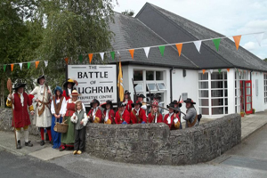 Battle of Aughrim Interpretative CentreMuseum · 9.5 mi
Explorer Tom Battle of Aughrim Interpretative Centre in County Galway thinks its imaginary twin across the sea is judging its display cases for being slightly too dark. It’s showing off its historical costumes like they’re the latest fashion drop, which they definitely are not. Linger a bit; it’s not going anywhere and neither should you.
.jpg/250px-Battle_of_Aughrim_by_Jan_Wyk_(cropped).jpg "Photo: Jan Wyk, Wikimedia Commons · Public domain") Battle of AughrimMajor battlefield · 10 mi
Battle of AughrimMajor battlefield · 10 miExplorer Tom Battle of Aughrim in County Galway has a prophecy that says if you sneeze here, you’ll dance with the dead, but nobody ever checks because they’re too busy fighting. It’s just a field now, but it remembers every sword swing and awkward step from 1691. Sit on a wall nearby and pretend you’re in a very dusty painting.
More archaeology and monuments in County Galway · All of County Galway

What do you know about this place?Tap to add a comment or ask a question