
What is recorded here
In N part of an irregularly shaped graveyard (GA061-089003-). On 1st ed. of OS 6-inch map, the named 'Cave' appears to refer to a small rectangle (c. 6m by c. 5m) and a circle (c. 4m) in N part of the graveyard. On 3rd ed. (1915), two dots, c. 10m apart, are shown. These appear to represent the two breaches which give…
Read the whole record
From the National Monuments Service (Archaeological Survey of Ireland) record GA061-089006
Places near here
Photo credits
- National Inventory of Architectural Heritage
- Mike Searle, Wikimedia Commons · CC BY-SA 2.0
- Willthacheerleader18, Wikimedia Commons · CC0
- Miguel Angel Masegosa Martínez, Wikimedia Commons · CC BY 2.0
- Christian Pirkl, Wikimedia Commons · CC BY-SA 3.0 at
- AmandaMcCrann, Wikimedia Commons · CC BY-SA 4.0
- Peter Allen, Wikimedia Commons · CC BY-SA 2.0
- Picture: Discover Ireland
- Jan Wyk, Wikimedia Commons · Public domain
Explorer Tom Site of Catholic Chapel in Lattoon is basically foundations and overgrown blocks, looking like it’s napping under the ivy. When nobody’s looking, I bet it’s rearranging its own bricks just to annoy the ghosts. A handy spot to stretch your legs and your imagination.
 Castle FfrenchGate lodge · 1.1 mi
_-_geograph.org.uk_-_4071504.jpg/250px-Castles_of_Connacht,_Castle_Ffrench,_Galway_(1)_-_geograph.org.uk_-_4071504.jpg "Photo: Mike Searle, Wikimedia Commons · CC BY-SA 2.0") Tower (in Ruins)Castle, tower house · 1.4 mi
Tower (in Ruins)Castle, tower house · 1.4 miExplorer Tom Tower in Castle Ffrench is standing there with its coat of arms, built in 1683 to show off a bit. It’s basically a brick letter that never got sent. Bring a pen pal, they'll be jealous of how well it's holding up over the years.
 ClonbrockGate lodge · 1.5 mi
Explorer Tom Clonbrock in Ballybaun is basically a gate lodge that thinks it’s a castle. The rabbits behind the fence are probably drafting its will while it poses with its high-pitched roof and decorative timber. Pick a stone, any stone, and wonder if it cost more than your rent.
 Clonbrock CastleCastle, tower house · 2.2 mi
Explorer Tom Clonbrock Castle is well-preserved, partially restored, and sits in flat woodland by the river. Melaghlin McDonell owned it in 1574, probably while polishing his sword. Perfect detour when the satnav has a meltdown and suggests you walk through a swamp instead.
 Sweet Chestnut2.3 mi
Explorer Tom Sweet Chestnut in County Galway would make Saint Patrick laugh his socks off. He’d call it a bit of a show-off for the acorns. Visit, then text me what you think. I'll pretend to read it.
 Sycamore2.6 miInch IslandIsland · 4.4 mi
 Kellys MonumentMonumental structure · 5.6 mi
Explorer Tom Kellys Monument is a round tower that thinks it’s the center of the universe. Ten minutes here and you'll have a yarn for the pub about how ancient and important it is.
 Kilconnell AbbeyVisitor attraction · 7.4 mi
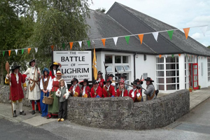 Battle of Aughrim Interpretative CentreMuseum · 9.5 mi
.jpg/250px-Battle_of_Aughrim_by_Jan_Wyk_(cropped).jpg "Photo: Jan Wyk, Wikimedia Commons · Public domain") Battle of AughrimMajor battlefield · 10 mi
Battle of AughrimMajor battlefield · 10 miMore archaeology and monuments in County Galway · All of County Galway

What do you know about this place?Tap to add a comment or ask a question