What is recorded here
Situated on a slight rise in a low-lying, level landscape, with the original shore of Ballyteige Lough that was known as Mablen Haven in the 17th century (Simington 1953, 125, 149), c. 250m to the S. The parish church of Ballymagir or Killag (WX051-003001-) is within a subrectangular graveyard (dims c. 40m NE-SW; c. 25-30m NW-SE) defined by earthen banks, with a masonry wall at NE where a path (L c. 30m) leads to a NW-SE public road.
From the National Monuments Service (Archaeological Survey of Ireland) record WX051-003002
Places near here
Photo credits
- National Inventory of Architectural Heritage
- kevin higgins, Geograph · CC BY-SA 2.0
- Kenneth Allen, Geograph · CC BY-SA 2.0
- kevin higgins, Wikimedia Commons · CC BY-SA 2.0
- Mike Searle, Wikimedia Commons · CC BY-SA 2.0
- Andreas F. Borchert, Wikimedia Commons · CC BY-SA 4.0
- Pam Brophy, Wikimedia Commons · CC BY-SA 2.0
- Oliver Dixon, Geograph · CC BY-SA 2.0
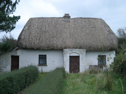 farm house1061 yd
 bridge1182 yd
 Cull IslandIsland · 1.8 mi
 Ivan Sutton Art ExhibitionGallery · 2.1 mi
 Kilmore Quay - Crehen Twinning MemorialMemorial · 2.2 mi
 Kilmore Quay Walking TrailVisitor information · 2.2 mi
 Ballyteigue BurrowNature reserve · 2.2 mi
_-_geograph.org.uk_-_3715787.jpg/250px-Castles_of_Leinster,_Ballyhealy,_Wexford_(1)_-_geograph.org.uk_-_3715787.jpg "Photo: Mike Searle, Wikimedia Commons · CC BY-SA 2.0") Castle (in ruins)Castle, tower house · 2.9 mi
Castle (in ruins)Castle, tower house · 2.9 mi Font in BallyconnickFont · 4.4 mi
 Little SalteeIslet · 4.6 mi
 Coolhull CastleHouse, fortified house · 5.0 mi
 Windmill5.0 mi
More archaeology and monuments in County Wexford · All of County Wexford
What do you know about this place?Tap to add a comment or ask a question